Nome - Nome City Field
Airport details
| Country | United States of America |
| State | Alaska |
| Region | |
| Municipality | Nome |
| Elevation | 59ft (18m) |
| Timezone | GMT -9 |
| Coordinates | 64.51129, -165.40047 |
| Magnetic var | |
| Type | land |
| Available since | X-Plane v10.40 |
| ICAO code | 94Z |
| IATA code | n/a |
| FAA code | 94Z |
Communication
| Nome City Field AWOS-3 | 121.450 |
| Nome City Field CTAF | 123.600 |
Nearby Points of Interest:
Discovery Saloon
-Swanberg Dredge
-Cape Nome Mining District Discovery Sites
-Cape Nome Roadhouse
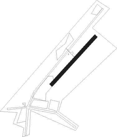
Runway info
| Runway 03 / 21 | ||
| length | 594m (1949ft) | |
| bearing | 68° / 248° | |
| width | 34m (112ft) | |
| surface | gravel | |
Nearby beacons
| code | identifier | dist | bearing | frequency |
|---|---|---|---|---|
| OYN | (NOME) DME | 0.8 | 272° | 113.80 |
| FDV | FORT DAVIS (NOME) NDB | 2.4 | 101° | 529 |
| OME | NOME VOR/DME | 4.1 | 100° | 115 |
Disclaimer
The information on this website is not for real aviation. Use this data with the X-Plane flight simulator only! Data taken with kind consent from X-Plane 12 source code and data files. Content is subject to change without notice.