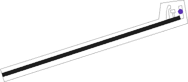
Fort Hill - Keystone
Airport details
| Country | United States of America |
| State | Pennsylvania |
| Region | |
| Airspace | Cleveland Ctr |
| Municipality | Elk Lick Township |
| Elevation | 2529ft (771m) |
| Timezone | GMT -5 |
| Coordinates | 39.77216, -79.21468 |
| Magnetic var | |
| Type | land |
| Available since | X-Plane v10.40 |
| ICAO code | 9PA7 |
| IATA code | n/a |
| FAA code | 9PA7 |
Communication
Nearby Points of Interest:
Fuller-Baker Log House
-Stanton's Mill
-Petersburg Tollhouse
-Mercy Chapel at Mill Run
-Kaese Mill
-Penrose Wolf Building
-Second National Bank of Meyersdale
-James Drane House
-Wills Creek Bollman Bridge
-Pennsylvania Railroad 3750
-Miller's Store
-Kentuck Knob
-Uptown Somerset Historic District
-Somerset County Courthouse
-Daniel B. Zimmerman Mansion
-Evergreen
-Shaw Mansion
-Kooser State Park Family Cabin District
-La Vale Tollgate House
-Anderson Chapel
-Henry Glassaway Davis House
-Downer Tavern
-Reckart Mill
-Wharton Furnace
-Lake City School
Runway info
| Runway 9 / 27 | ||
| length | 556m (1824ft) | |
| bearing | 79° / 259° | |
| width | 11m (35ft) | |
| surface | asphalt | |
Nearby beacons
| code | identifier | dist | bearing | frequency |
|---|---|---|---|---|
| GRV | DME | 11.1 | 130° | 112.30 |
| IHD | INDIAN HEAD VORTAC | 13.8 | 325° | 108.20 |
| SYS | STOYSTOWN (SOMERSET) NDB | 23.3 | 44° | 209 |
| VV | CAMOR (CONNELLSVILLE) NDB | 25.3 | 282° | 299 |
| MGW | MORGANTOWN VOR/DME | 32.5 | 252° | 111.60 |
| ESL | KESSEL VOR/DME | 34.4 | 158° | 110.80 |
| JST | JOHNSTOWN VOR/DME | 37 | 35° | 113 |
| AGC | ALLEGHENY (PITTSBURGH) VOR/DME | 48.6 | 302° | 110 |
| REC | REVLOC VOR/DME | 51.2 | 31° | 110.60 |
| RQY | RANDOLPH CO. (ELKINS) NDB | 60.6 | 216° | 284 |
| MMJ | (PITTSBURGH) DME | 62.2 | 306° | 112 |
| EKN | ELKINS VORTAC | 65.8 | 226° | 114.20 |
Disclaimer
The information on this website is not for real aviation. Use this data with the X-Plane flight simulator only! Data taken with kind consent from X-Plane 12 source code and data files. Content is subject to change without notice.
