Maricopa - Ak-chin Regl
Airport details
| Country | United States of America |
| State | Arizona |
| Region | K2 |
| Airspace | Albuquerque Ctr |
| Municipality | Pinal County |
| Elevation | 1307ft (398m) |
| Timezone | GMT -7 |
| Coordinates | 32.99055, -111.91883 |
| Magnetic var | |
| Type | land |
| Available since | X-Plane v10.30 |
| ICAO code | A39 |
| IATA code | n/a |
| FAA code | A39 |
Communication
| Ak-Chin Regl AWOS-3 | 126.900 |
| Ak-Chin Regl CTAF | 122.900 |
Nearby Points of Interest:
C.H. Cook Memorial Church
-Henry and Anna Kochsmeier House
-Casa Grande Woman's Club Building
-Casa Grande Stone Church
-Cruz Trading Post
-Casa Grande Depot
-Fisher Memorial Home
-First Baptist Church
-White House
-Saint Anthony's Church
-Johnston's Grocery Store
-Casa Grande Hospital
-Valley National Bank
-Walter Wilbur House
-Coolidge Woman's Club
-Rittenhouse Elementary School
-Niels Petersen House
-Double Butte Cemetery
-B. B. Moeur Activity Building
-Borden Milk Co. Creamery and Ice Factory
-Matthews Hall
-President's House
-Industrial Arts Building
-Old Main
-Administration/Science Building
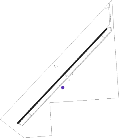
Runway info
| Runway 4 / 22 | ||
| length | 1466m (4810ft) | |
| bearing | 53° / 233° | |
| width | 15m (50ft) | |
| surface | asphalt | |
| displ threshold | 0m (0ft) / 88m (289ft) | |
Nearby beacons
| code | identifier | dist | bearing | frequency |
|---|---|---|---|---|
| TFD | STANFIELD (CASA GRANDE) VORTAC | 6.3 | 174° | 114.80 |
| IWA | WILLIE (PHOENIX) VORTAC | 23 | 41° | 113.30 |
| PXR | PHOENIX VORTAC | 26.6 | 353° | 115.60 |
| GBN | GILA BEND VORTAC | 38.1 | 267° | 116.60 |
| LUF | LUKE (GLENDALE) TACAN | 40.2 | 320° | 113 |
| AVQ | MARANA NDB | 49.7 | 129° | 245 |
| BXK | BUCKEYE VORTAC | 53.3 | 297° | 110.60 |
| RBJ | ROBLES (TUCSON) NDB | 61.8 | 149° | 220 |
| RYN | RYAN (TUCSON) NDB | 63.9 | 138° | 338 |
Disclaimer
The information on this website is not for real aviation. Use this data with the X-Plane flight simulator only! Data taken with kind consent from X-Plane 12 source code and data files. Content is subject to change without notice.