Tri-city
Airport details
| Country | United States of America |
| State | Illinois |
| Region | |
| Airspace | Chicago Ctr |
| Municipality | LaSalle County |
| Elevation | 664ft (202m) |
| Timezone | GMT -6 |
| Coordinates | 41.41996, -89.12564 |
| Magnetic var | |
| Type | land |
| Available since | X-Plane v10.40 |
| ICAO code | C68 |
| IATA code | n/a |
| FAA code | n/a |
Communication
Nearby Points of Interest:
Hegeler Carus Mansion
-Julius W. Hegeler I House
-LaSalle City Building
-LaSalle Downtown Commercial District
-Grand Village of the Illinois
-Wood-Tellkamp House
-Fisher-Nash-Griggs House
-Ottawa Commercial Historic District
-Knuessl Building
-Washington Park Historic District
-Nisbet Homestead Farm
-John Hossack House
-Edward Pulsifer House
-Jeremiah Strawn House
-Putnam County Courthouse
-Andrew J. O'Conor III House
-Owen Lovejoy House
-Richard M. Skinner House
-Greenwood Cottage
-Princeton Chapter House
-Princeton North Main Street Historic District
-Stephen Wright House
-Marseilles Lock and Dam Historic District
-Cortland Condit House
-Stevens House
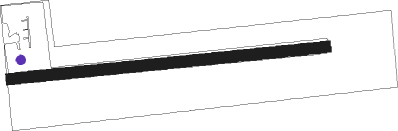
Runway info
| Runway 09 / 27 | ||
| length | 779m (2556ft) | |
| bearing | 89° / 269° | |
| width | 27m (90ft) | |
| surface | grass | |
Nearby beacons
| code | identifier | dist | bearing | frequency |
|---|---|---|---|---|
| BDF | BRADFORD VORTAC | 26 | 241° | 114.70 |
| DTG | DWIGHT NDB | 35.6 | 113° | 344 |
| JOT | JOLIET VOR/DME | 37.1 | 81° | 112.30 |
| PLL | POLO VOR/DME | 37.3 | 324° | 111.20 |
| PNT | PONTIAC VOR/DME | 40 | 147° | 109.60 |
| DPA | DUPAGE (CHICAGO) VOR/DME | 44.8 | 59° | 108.40 |
| RFD | DME | 48.4 | 355° | 110.80 |
| LH | EGROW (BLOOMINGTON-NORMAL) NDB | 52.8 | 164° | 334 |
| PI | TUNGG (PEORIA) NDB | 53.3 | 210° | 356 |
| PIA | PEORIA VORTAC | 53.7 | 222° | 115.20 |
| BMI | BLOOMINGTON VOR/DME | 57 | 168° | 108.20 |
| RBS | ROBERTS VOR/DME | 66.5 | 131° | 116.80 |
Disclaimer
The information on this website is not for real aviation. Use this data with the X-Plane flight simulator only! Data taken with kind consent from X-Plane 12 source code and data files. Content is subject to change without notice.