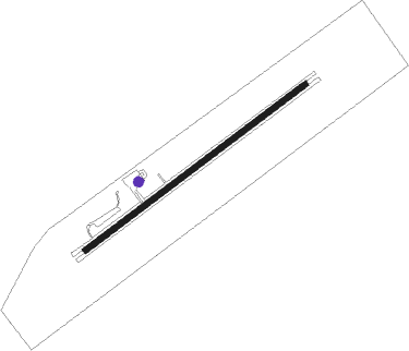
Clarenville
Airport details
| Country | Canada |
| State | Newfoundland and Labrador |
| Region | CY |
| Airspace | Gander Oceanic Ctr |
| Municipality | Newfoundland |
| Elevation | 203ft (62m) |
| Timezone | GMT -3.5 |
| Coordinates | 48.27466, -53.92393 |
| Magnetic var | |
| Type | land |
| Available since | X-Plane v11.50 |
| ICAO code | CCZ3 |
| IATA code | n/a |
| FAA code | n/a |
Communication
| Clarenville CTAF | 123.200 |
| Clarenville GANDER CNTR | 132.100 |
Runway info
| Runway 08 / 26 | ||
| length | 1198m (3930ft) | |
| bearing | 67° / 247° | |
| width | 23m (75ft) | |
| surface | asphalt | |
| blast zone | 63m (207ft) / 65m (213ft) | |
Nearby beacons
| code | identifier | dist | bearing | frequency |
|---|---|---|---|---|
| YQX | GANDER VOR/DME | 44.7 | 316° | 112.70 |
| QX | GANDER NDB | 50.9 | 313° | 280 |
Instrument approach procedures
| runway | airway (heading) | route (dist, bearing) |
|---|---|---|
| RW08 | LIBEK (46°) | LIBEK TEVAB (5mi, 317°) 2400ft |
| RW08 | ULENO (84°) | ULENO TEVAB (5mi, 136°) 2400ft |
| RNAV | TEVAB 2400ft XUDSU (6mi, 67°) 2050ft IGRUT (3mi, 67°) 1120ft CCZ3 (3mi, 67°) 228ft SILSA (2mi, 67°) OMSOR (3mi, 67°) 2400ft OMSOR (turn) | |
| RW26 | LOLRO (265°) | LOLRO TETED (5mi, 316°) 1800ft |
| RW26 | VISUK (223°) | VISUK TETED (5mi, 136°) 1800ft |
| RNAV | TETED 1800ft IGTOK (6mi, 247°) 1590ft ANVOK (1mi, 247°) 1180ft CCZ3 (3mi, 247°) 253ft BIMKA (2mi, 247°) UBVIT (5mi, 247°) 2400ft UBVIT (turn) |
Disclaimer
The information on this website is not for real aviation. Use this data with the X-Plane flight simulator only! Data taken with kind consent from X-Plane 12 source code and data files. Content is subject to change without notice.
