Maidstone
Airport details
| Country | Canada |
| State | Saskatchewan |
| Region | CY |
| Airspace | Winnipeg Ctr |
| Municipality | Eldon No. 471 |
| Elevation | 1994ft (608m) |
| Timezone | GMT -6 |
| Coordinates | 53.09634, -109.32571 |
| Magnetic var | |
| Type | land |
| Available since | X-Plane v10.40 |
| ICAO code | CJH3 |
| IATA code | n/a |
| FAA code | n/a |
Communication
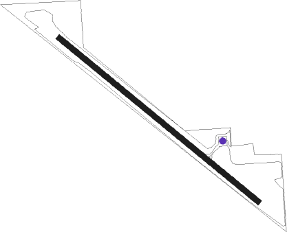
Runway info
| Runway 12 / 30 | ||
| length | 1099m (3606ft) | |
| bearing | 120° / 300° | |
| width | 23m (75ft) | |
| surface | asphalt | |
Nearby beacons
| code | identifier | dist | bearing | frequency |
|---|---|---|---|---|
| YLL | LLOYDMINSTER NDB | 30.1 | 286° | 241 |
Instrument approach procedures
| runway | airway (heading) | route (dist, bearing) |
|---|---|---|
| RW12 | IKBED (101°) | IKBED EPVOT (6mi, 58°) 3700ft |
| RW12 | PUROK (148°) | PUROK EPVOT (6mi, 238°) 3700ft |
| RNAV | EPVOT 3700ft AGMOM (6mi, 120°) 3700ft VERGA (3mi, 120°) 2610ft CJH3 (2mi, 120°) 2034ft XUDMA (7mi, 120°) 3900ft XUDMA (turn) | |
| RW30 | EBDIG (281°) | EBDIG DASIN (6mi, 238°) 3700ft |
| RW30 | KASIX (329°) | KASIX DASIN (6mi, 58°) 3700ft |
| RNAV | DASIN 3700ft AGDUB (6mi, 300°) 3700ft CJH3 (5mi, 300°) 2015ft OMRET (7mi, 300°) 3900ft OMRET (turn) |
Disclaimer
The information on this website is not for real aviation. Use this data with the X-Plane flight simulator only! Data taken with kind consent from X-Plane 12 source code and data files. Content is subject to change without notice.