La Grande-3
Airport details
| Country | Canada |
| State | Quebec |
| Region | CY |
| Airspace | Montreal Ctr |
| Municipality | Eeyou Istchee James Bay |
| Elevation | 774ft (236m) |
| Timezone | GMT -5 |
| Coordinates | 53.57178, -76.19629 |
| Magnetic var | |
| Type | land |
| Available since | X-Plane v10.40 |
| ICAO code | CYAD |
| IATA code | YAR |
| FAA code | n/a |
Communication
| La Grande-3 UNICOM | 123.000 |
Runway info
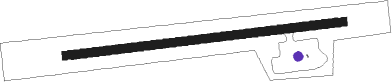
| Runway 10 / 28 | ||
| length | 1528m (5013ft) | |
| bearing | 89° / 269° | |
| width | 46m (150ft) | |
| surface | gravel | |
Instrument approach procedures
| runway | airway (heading) | route (dist, bearing) |
|---|---|---|
| RW10-Y | IMUNI (104°) | IMUNI TOXIR (5mi, 175°) 2200ft |
| RW10-Y | MEMKU (72°) | MEMKU TOXIR (5mi, 355°) 2200ft |
| RNAV | TOXIR 2200ft KAXON (6mi, 88°) 2100ft XOROD (2mi, 88°) 1530ft CYAD (3mi, 88°) 825ft USBAD (5mi, 88°) 2600ft USBAD (turn) | |
| RW10-Z | IMUNI (104°) | IMUNI TOXIR (5mi, 175°) 2200ft |
| RW10-Z | MEMKU (72°) | MEMKU TOXIR (5mi, 355°) 2200ft |
| RNAV | TOXIR 2200ft KAXON (6mi, 88°) 2100ft XOROD (2mi, 88°) 1530ft CYAD (3mi, 88°) 825ft USBAD (5mi, 88°) 2600ft USBAD (turn) 2600ft | |
| RW28-Y | NAMGO (284°) | NAMGO IMOGA (5mi, 356°) 2400ft |
| RW28-Y | TIDEN (252°) | TIDEN IMOGA (5mi, 176°) 2400ft |
| RNAV | IMOGA 2400ft GADSA (6mi, 269°) 2100ft XUDEB (2mi, 268°) 1500ft CYAD (3mi, 268°) 797ft BOLVI (5mi, 268°) 2600ft BOLVI (turn) | |
| RW28-Z | NAMGO (284°) | NAMGO IMOGA (5mi, 356°) 2400ft |
| RW28-Z | TIDEN (252°) | TIDEN IMOGA (5mi, 176°) 2400ft |
| RNAV | IMOGA 2400ft GADSA (6mi, 269°) 2100ft XUDEB (2mi, 268°) 1500ft CYAD (3mi, 268°) 797ft BOLVI (5mi, 268°) 2600ft BOLVI (turn) 2600ft |
Disclaimer
The information on this website is not for real aviation. Use this data with the X-Plane flight simulator only! Data taken with kind consent from X-Plane 12 source code and data files. Content is subject to change without notice.