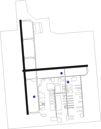
Calgary - Calgary/springbank
Airport details
| Country | Canada |
| State | Alberta |
| Region | CY |
| Airspace | Edmonton Ctr |
| Municipality | Rocky View County |
| Elevation | 3938ft (1200m) |
| Timezone | GMT -7 |
| Coordinates | 51.10400, -114.37009 |
| Magnetic var | |
| Type | land |
| Available since | X-Plane v10.40 |
| ICAO code | CYBW |
| IATA code | YBW |
| FAA code | YBW |
Communication
| Calgary/Springbank ATIS | 127.900 |
| Calgary/Springbank Ground Control | 121.800 |
| Calgary/Springbank Tower | 118.200 |
| Calgary/Springbank Departure | 124.525 |
Approach frequencies
| ILS-cat-I | RW35 | 111.7 | 18.00mi |
| 3° GS | RW35 | 111.7 | 18.00mi |
Nearby beacons
| code | identifier | dist | bearing | frequency |
|---|---|---|---|---|
| YYC | CALGARY VOR/DME | 18.4 | 89° | 116.70 |
| K2 | OLDS-DIDSBURY NDB | 37.7 | 23° | 376 |
| 9G | SUNDRE NDB | 42.2 | 335° | 405 |
Departure and arrival routes
| Transition altitude | 18000ft |
| Transition level | 18000ft |
| SID end points | distance | outbound heading | |
|---|---|---|---|
| RW08 | |||
| CYBW3 | 10mi | 183° | |
| RW17 | |||
| CYBW3 | 10mi | 183° | |
| RW26 | |||
| CYBW3 | 10mi | 183° | |
| RW35 | |||
| CYBW3 | 10mi | 183° | |
| STAR starting points | distance | inbound heading | |
|---|---|---|---|
| RW17 | |||
| BRAGG4 | 26.1 | 36° | |
| KIPEV3 | 21.7 | 154° | |
| MADYN2 | 23.8 | 195° | |
| ELBOW3 | 17.7 | 352° | |
| RW35 | |||
| BRAGG4 | 26.1 | 36° | |
| KIPEV3 | 21.7 | 154° | |
| MADYN2 | 23.8 | 195° | |
| ELBOW3 | 17.7 | 352° | |
Instrument approach procedures
| runway | airway (heading) | route (dist, bearing) |
|---|---|---|
| RW17 | HEMPP (150°) | HEMPP MEGMO (16mi, 133°) 6000ft |
| RW17 | OTSEN (212°) | OTSEN MEGMO (5mi, 270°) 6000ft |
| RW17 | RIGOT (43°) | RIGOT NOSAB (23mi, 360°) 7000ft MEGMO (6mi, 90°) 6000ft |
| RNAV | MEGMO 6000ft KEMKO (5mi, 180°) 6000ft LOPSI (3mi, 180°) 5030ft CYBW (4mi, 172°) 3980ft (6307mi, 114°) 4400ft RIGOT (6316mi, 294°) 7000ft RIGOT (turn) | |
| RW35 | LOBTA (325°) | LOBTA SEKEM (5mi, 270°) 6000ft |
| RW35 | RIGOT (43°) | RIGOT SEKEM (6mi, 90°) 6000ft |
| RNAV | SEKEM 6000ft XUBUM (4mi, 360°) 5970ft TARTI (2mi, 360°) 5300ft CYBW (4mi, 7°) 3985ft (6307mi, 114°) 4400ft RIGOT (6316mi, 294°) 7000ft RIGOT (turn) |
Holding patterns
| STAR name | hold at | type | turn | heading* | altitude | leg | speed limit |
|---|---|---|---|---|---|---|---|
| BRAGG4 | PIBSO | VHF | right | 236 (56)° | 1.0min timed | ICAO rules | |
| ELBOW3 | EBGAL | VHF | right | 120 (300)° | > 18000ft | 1.5min timed | ICAO rules |
| ELBOW3 | MOBEK | VHF | right | 120 (300)° | 1.0min timed | ICAO rules | |
| KIPEV3 | ADVOX | VHF | left | 310 (130)° | 14001ft - 22000ft | 1.5min timed | 230 |
| MADYN2 | BIRKO | VHF | right | 56 (236)° | 10000ft - 21000ft | 1.5min timed | ICAO rules |
| MADYN2 | PIKLA | VHF | right | 56 (236)° | 5200ft - 30000ft | 1.5min timed | ICAO rules |
| *) magnetic outbound (inbound) holding course | |||||||
Disclaimer
The information on this website is not for real aviation. Use this data with the X-Plane flight simulator only! Data taken with kind consent from X-Plane 12 source code and data files. Content is subject to change without notice.

