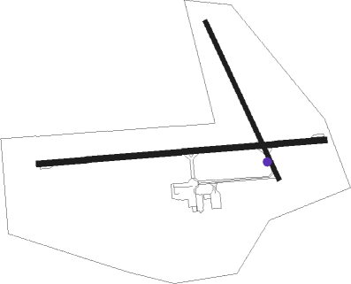
Estevan - Estevan Regional
Airport details
| Country | Canada |
| State | Saskatchewan |
| Region | CY |
| Airspace | Winnipeg Ctr |
| Municipality | Division No. 1 |
| Elevation | 1903ft (580m) |
| Timezone | GMT -6 |
| Coordinates | 49.21020, -102.96576 |
| Magnetic var | |
| Type | land |
| Available since | X-Plane v10.40 |
| ICAO code | CYEN |
| IATA code | YEN |
| FAA code | n/a |
Communication
| Estevan Regional CTAF | 123.000 |
Nearby beacons
| code | identifier | dist | bearing | frequency |
|---|---|---|---|---|
| ISN | WILLISTON VOR/DME | 65.3 | 219° | 116.30 |
Instrument approach procedures
| runway | airway (heading) | route (dist, bearing) |
|---|---|---|
| RW08 | BODLI (107°) | BODLI DUXEK (6mi, 179°) 3600ft |
| RW08 | EMDAT (72°) | EMDAT DUXEK (6mi, 359°) 3600ft |
| RNAV | DUXEK 3600ft NOPUV (6mi, 90°) 3600ft CYEN (6mi, 89°) 1949ft KASEX (7mi, 91°) 4000ft KASEX (turn) | |
| RW15 | ITNEX (123°) | ITNEX LOLMA (5mi, 76°) 3600ft |
| RW15 | MAVEM (190°) | MAVEM LOLMA (5mi, 256°) 3600ft |
| RNAV | LOLMA 3600ft BISKU (6mi, 150°) 3600ft CYEN (5mi, 153°) 1937ft GABIR (7mi, 149°) 4000ft GABIR (turn) | |
| RW26 | ALGUP (253°) | ALGUP EBGOG (6mi, 180°) 3600ft |
| RW26 | DASUB (288°) | DASUB EBGOG (6mi, 360°) 3600ft |
| RNAV | EBGOG 3600ft IKPAD (6mi, 270°) 3600ft CYEN (6mi, 271°) 1947ft OBTET (7mi, 269°) 4000ft OBTET (turn) | |
| RW33 | ILAKI (302°) | ILAKI KARAV (5mi, 256°) 3600ft |
| RW33 | UDBIS (7°) | UDBIS KARAV (5mi, 76°) 3600ft |
| RNAV | KARAV 3600ft MISEP (6mi, 331°) 3600ft CYEN (5mi, 328°) 1941ft VESBO (7mi, 332°) 4000ft VESBO (turn) |
Disclaimer
The information on this website is not for real aviation. Use this data with the X-Plane flight simulator only! Data taken with kind consent from X-Plane 12 source code and data files. Content is subject to change without notice.

