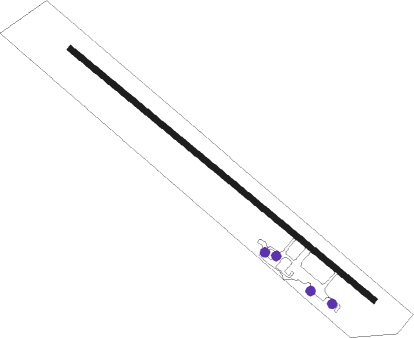
Edmundston
Airport details
| Country | Canada |
| State | Quebec |
| Region | CY |
| Airspace | Montreal Ctr |
| Municipality | Dégelis |
| Elevation | 490ft (149m) |
| Timezone | GMT -4 |
| Coordinates | 47.49055, -68.48194 |
| Magnetic var | |
| Type | land |
| Available since | X-Plane v10.40 |
| ICAO code | CYES |
| IATA code | n/a |
| FAA code | n/a |
Communication
| EDMUNDSTON CTAF/UNICOM | 122.800 |
Runway info
| Runway 16 / 34 | ||
| length | 1528m (5013ft) | |
| bearing | 123° / 303° | |
| width | 23m (75ft) | |
| surface | asphalt | |
| displ threshold | 74m (243ft) / 67m (220ft) | |
Nearby beacons
| code | identifier | dist | bearing | frequency |
|---|---|---|---|---|
| PQI | PRESQUE ISLE VOR/DME | 45.8 | 152° | 116.40 |
Departure and arrival routes
| Transition altitude | 18000ft |
| Transition level | 18000ft |
| SID end points | distance | outbound heading | |
|---|---|---|---|
| RW34 | |||
| EPREL1 | 16mi | 303° | |
Instrument approach procedures
| runway | airway (heading) | route (dist, bearing) |
|---|---|---|
| RW16 | ALISU (143°) | ALISU IGTOG (5mi, 230°) 2600ft |
| RW16 | EBGIR (100°) | EBGIR IGTOG (5mi, 50°) 2700ft |
| RNAV | IGTOG 2600ft DEDEL (6mi, 119°) 2200ft KAVGU (3mi, 119°) 1480ft CYES (3mi, 119°) 540ft ONDEP (7mi, 119°) 3500ft ONDEP (turn) | |
| RW34 | KELTU (277°) | KELTU ALRUK (5mi, 225°) 2800ft |
| RW34 | OBNOD (319°) | OBNOD ALRUK (5mi, 45°) 2500ft |
| RNAV | ALRUK 2500ft LEVUV (6mi, 295°) 2400ft VOBES (2mi, 295°) 1720ft EMKOB (turn) 1400ft SAXOK (2mi, 295°) 545ft NOREB (7mi, 294°) 3500ft NOREB (turn) |
Disclaimer
The information on this website is not for real aviation. Use this data with the X-Plane flight simulator only! Data taken with kind consent from X-Plane 12 source code and data files. Content is subject to change without notice.
