Edson
Airport details
| Country | Canada |
| State | Alberta |
| Region | CY |
| Airspace | Edmonton Ctr |
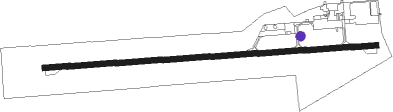
| Municipality | Edson |
| Elevation | 3041ft (927m) |
| Timezone | GMT -7 |
| Coordinates | 53.57894, -116.46506 |
| Magnetic var | |
| Type | land |
| Available since | X-Plane v10.40 |
| ICAO code | CYET |
| IATA code | YET |
| FAA code | n/a |
Communication
| Edson AWOS | 128.750 |
| Edson Traffic | 123.200 |
Nearby beacons
| code | identifier | dist | bearing | frequency |
|---|---|---|---|---|
| YZU | WHITECOURT VOR/DME | 41.4 | 50° | 112.50 |
| 5F | FOX CREEK NDB | 49 | 340° | 353 |
Instrument approach procedures
| runway | airway (heading) | route (dist, bearing) |
|---|---|---|
| RW07 | EPTIT (74°) | EPTIT AVSAD (5mi, 1°) 4700ft |
| RW07 | KEDVA (106°) | KEDVA AVSAD (5mi, 181°) 4700ft |
| RNAV | AVSAD 4700ft IPSEX (5mi, 90°) 4600ft XUBKU (1mi, 90°) 4210ft CYET (4mi, 90°) 3092ft LIBUD (8mi, 90°) 6100ft LIBUD (turn) | |
| RW25 | ITKON (288°) | ITKON EPSOR (5mi, 1°) 4400ft |
| RW25 | KEKTO (253°) | KEKTO EPSOR (5mi, 181°) 4400ft |
| RNAV | EPSOR 4400ft VILBO (5mi, 270°) 4350ft CYET (4mi, 270°) 3075ft MENPO (8mi, 270°) 6000ft MENPO (turn) |
Disclaimer
The information on this website is not for real aviation. Use this data with the X-Plane flight simulator only! Data taken with kind consent from X-Plane 12 source code and data files. Content is subject to change without notice.