Hamilton - John C Munro Hamilton Intl
Airport details
| Country | Canada |
| State | Ontario |
| Region | CY |
| Airspace | Toronto Ctr |
| Municipality | Hamilton |
| Elevation | 777ft (237m) |
| Timezone | GMT -5 |
| Coordinates | 43.16399, -79.93458 |
| Magnetic var | |
| Type | land |
| Available since | X-Plane v10.40 |
| ICAO code | CYHM |
| IATA code | YHM |
| FAA code | YHM |
Communication
| John C Munro Hamilton Intl ATIS | 128.100 |
| John C Munro Hamilton Intl Ground Control | 121.600 |
| John C Munro Hamilton Intl Tower | 125.000 |
| John C Munro Hamilton Intl Toronto Terminal Approach | 119.700 |
| John C Munro Hamilton Intl Toronto Terminal Departure | 119.700 |
Approach frequencies
| LOC | RW30 | 110.9 | 18.00mi |
| ILS-cat-II | RW12 | 110.9 | 18.00mi |
| 3° GS | RW12 | 110.9 | 18.00mi |
Nearby Points of Interest:
Hamilton City Hall
-Victoria Hall
-Burlington Heights
-Former Hamilton Customs House
-Hamilton Waterworks
-Erland Lee Museum
-Ruthven Park
-Crawford Lake Conservation Area
-Galt railway station
-Nanticoke Generating Station
-Cliff Site
-Comfort Maple
-Mohawk Island Lighthouse
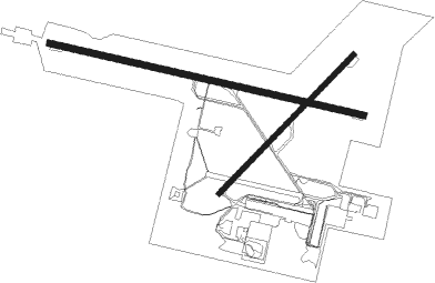
Runway info
Runway 12 / 30  | ||
| length | 3053m (10016ft) | |
| bearing | 103° / 283° | |
| width | 61m (200ft) | |
| surface | asphalt | |
| displ threshold | 500m (1640ft) / 0m (0ft) | |
| blast zone | 40m (131ft) / 45m (148ft) | |
| Runway 06 / 24 | ||
| length | 1833m (6014ft) | |
| bearing | 57° / 237° | |
| width | 46m (150ft) | |
| surface | asphalt | |
Nearby beacons
| code | identifier | dist | bearing | frequency |
|---|---|---|---|---|
| HM | HAMILTON NDB | 4 | 239° | 221 |
| ZHA | ANCASTER (HAMILTON) NDB | 4.5 | 290° | 397 |
| ZHM | BINBROOK (HAMILTON) NDB | 6.3 | 98° | 266 |
| FD | BRANTFORD NDB | 21.8 | 259° | 207 |
| ZKF | WELLINGTON (KITCHENER) NDB | 25 | 313° | 335 |
| WT | (KITCHENER) DME | 26.2 | 304° | 115 |
| SN | ST CATHARINES NDB | 29.7 | 91° | 408 |
| ZYZ | QUEENSWAY (TORONTO) NDB | 32.1 | 40° | 368 |
| YYZ | TORONTO VOR/DME | 32.4 | 32° | 112.15 |
| YTP | PEARSON (TORONTO) VOR/DME | 32.6 | 28° | 116.55 |
| ZTO | WOODHILL (TORONTO) NDB | 35.9 | 22° | 403 |
| TZ | GIBRALTAR POINT NDB | 36 | 51° | 257 |
| IAG | NIAGARA FALLS TACAN | 42.8 | 93° | 111 |
| DKK | DME | 49.8 | 136° | 116.20 |
| KZ | BUTTONVILLE NDB | 53.1 | 38° | 248 |
| YMS | MANS (MANSFIELD) VOR/DME | 59.5 | 348° | 114.50 |
| JHW | JAMESTOWN VOR/DME | 68.7 | 140° | 114.70 |
Departure and arrival routes
| Transition altitude | 18000ft |
| Transition level | 18000ft |
| SID end points | distance | outbound heading | |
|---|---|---|---|
| RW06 | |||
| CYHM9 | 31mi | 111° | |
| RW12 | |||
| CYHM9 | 31mi | 111° | |
| RW24 | |||
| CYHM9 | 31mi | 111° | |
| RW30 | |||
| MUNR2 | 31mi | 111° | |
| STAR starting points | distance | inbound heading | |
|---|---|---|---|
| RW06 | |||
| TIKUM2 | 14.2 | 4° | |
| AVSOX2 | 30.3 | 82° | |
| UDMIK3 | 32.4 | 212° | |
| COLTS7 | 29.4 | 288° | |
| RW12 | |||
| TIKUM2 | 14.2 | 4° | |
| AVSOX2 | 30.3 | 82° | |
| UDMIK3 | 32.4 | 212° | |
| COLTS7 | 29.4 | 288° | |
| RW24 | |||
| TIKUM2 | 14.2 | 4° | |
| AVSOX2 | 30.3 | 82° | |
| UDMIK3 | 32.4 | 212° | |
| COLTS7 | 29.4 | 288° | |
| RW30 | |||
| TIKUM2 | 14.2 | 4° | |
| AVSOX2 | 30.3 | 82° | |
| UDMIK3 | 32.4 | 212° | |
| COLTS7 | 29.4 | 288° | |
Instrument approach procedures
| runway | airway (heading) | route (dist, bearing) |
|---|---|---|
| RW06-Z | IGTUT (29°) | IGTUT DAXAT (5mi, 310°) 2300ft |
| RW06-Z | LEVEX (80°) | LEVEX DAXAT (5mi, 130°) 2300ft |
| RNAV | DAXAT 2300ft VIBKA (6mi, 57°) 2200ft CYHM (4mi, 59°) 821ft MUXIG (11mi, 57°) 3100ft MUXIG (turn) | |
| RW12-Z | PUSAM (87°) | PUSAM LOGLI (5mi, 23°) 2200ft |
| RW12-Z | REXUG (126°) | REXUG LOGLI (5mi, 203°) 2200ft |
| RNAV | LOGLI 2200ft IGTIG (6mi, 103°) 2200ft CYHM (5mi, 109°) 826ft NORAG (4mi, 96°) 2800ft NORAG (turn) | |
| RW24-Z | NOPOP (257°) | NOPOP MUXIG (5mi, 310°) 2500ft |
| RW24-Z | UDMIK (211°) | UDMIK MUXIG (5mi, 130°) 2500ft |
| RNAV | MUXIG 2500ft KEDIS (6mi, 237°) 2200ft CYHM (5mi, 236°) 806ft IKLOP (11mi, 238°) 3100ft IKLOP (turn) | |
| RW30-Z | KEDBU (302°) | KEDBU DELVA (5mi, 23°) 2200ft |
| RW30-Z | OTROX (261°) | OTROX DELVA (5mi, 203°) 2200ft |
| RNAV | DELVA 2200ft GOPEB (5mi, 283°) 2200ft CYHM (5mi, 277°) 816ft EBKEM (9mi, 286°) 2300ft EBKEM (turn) 2300ft |
Disclaimer
The information on this website is not for real aviation. Use this data with the X-Plane flight simulator only! Data taken with kind consent from X-Plane 12 source code and data files. Content is subject to change without notice.