Kamloops
Airport details
| Country | Canada |
| State | British Columbia |
| Region | CY |
| Airspace | Vancouver Ctr |
| Municipality | Kamloops |
| Elevation | 1131ft (345m) |
| Timezone | GMT -8 |
| Coordinates | 50.70251, -120.44861 |
| Magnetic var | |
| Type | land |
| Available since | X-Plane v10.40 |
| ICAO code | CYKA |
| IATA code | YKA |
| FAA code | YKA |
Communication
| Kamloops Clearance Delivery | 121.900 |
| Kamloops Radio | 125.700 |
| Kamloops CTR Vancouver | 132.350 |
Approach frequencies
| LOC | RW27 | 109.9 | 18.00mi |
| ILS-cat-I | RW09 | 109.3 | 18.00mi |
| 3.1° GS | RW09 | 109.3 | 18.00mi |
Runway info
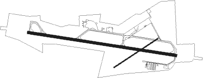
Runway 09 / 27  | ||
| length | 2432m (7979ft) | |
| bearing | 98° / 278° | |
| width | 45m (148ft) | |
| surface | asphalt | |
| blast zone | 30m (98ft) / 20m (66ft) | |
| Runway 04 / 22 | ||
| length | 845m (2772ft) | |
| bearing | 71° / 251° | |
| width | 15m (49ft) | |
| surface | asphalt | |
| displ threshold | 208m (682ft) / 0m (0ft) | |
Nearby beacons
| code | identifier | dist | bearing | frequency |
|---|---|---|---|---|
| YWB | WESTBANK (KELOWNA) NDB | 62 | 137° | 389 |
Departure and arrival routes
| Transition altitude | 18000ft |
| Transition level | 18000ft |
| SID end points | distance | outbound heading | |
|---|---|---|---|
| RW09 | |||
| KEBRA1 | 21mi | 99° | |
| RW27 | |||
| OLONA1 | 21mi | 276° | |
Instrument approach procedures
| runway | airway (heading) | route (dist, bearing) |
|---|---|---|
| RW09-Y | BOTAV (98°) | BOTAV 8000ft IGTED (10mi, 98°) 4900ft GUBIG (3mi, 98°) 4000ft |
| RW09-Y | DEMMA (155°) | DEMMA 8000ft XETER (5mi, 271°) 6800ft KEBKA (3mi, 252°) 5700ft MEDBI (2mi, 205°) 5100ft GUBIG (3mi, 129°) 4000ft |
| RW09-Y | YAROW (76°) | YAROW EMGEK (12mi, 63°) 9000ft OVENA (7mi, 63°) 8100ft DAVNU (4mi, 64°) 6900ft XUDUM (4mi, 64°) 5700ft IGTED (3mi, 82°) 4900ft GUBIG (3mi, 98°) 4000ft |
| RNAV | GUBIG 4000ft CYKA (9mi, 99°) 1186ft IKBIV (16mi, 99°) 7000ft IKBIV (turn) | |
| RW09-Z | EBLEM (111°) | EBLEM 8000ft DUVON (6mi, 200°) 6200ft |
| RW09-Z | YAROW (76°) | YAROW EMGEK (12mi, 63°) 9000ft OVENA (7mi, 63°) 8100ft AXUDO (3mi, 32°) 7200ft DUVON (4mi, 32°) 6200ft |
| RNAV | DUVON 6200ft NADGA (6mi, 98°) 4900ft LESAP (2mi, 98°) 4500ft CYKA (10mi, 99°) 1186ft IKBIV (16mi, 99°) 7000ft IKBIV (turn) | |
| RW27-Y | DEDEK (324°) | DEDEK 8100ft VOLUP (6mi, 85°) 6300ft XEVAG (4mi, 55°) 5300ft LEVOP (4mi, 310°) 4400ft |
| RW27-Y | MODUM (248°) | MODUM 8000ft AVOLO (3mi, 145°) 7100ft OMEMU (3mi, 145°) 6200ft EBKIR (2mi, 176°) 5600ft LEVOP (4mi, 251°) 4400ft |
| RW27-Y | VOMAD (280°) | VOMAD 8000ft AXIRA (7mi, 281°) 5900ft LEVOP (5mi, 281°) 4400ft |
| RNAV | LEVOP 4400ft CYKA (10mi, 278°) 1183ft EPVEK (15mi, 278°) 7000ft EPVEK (turn) | |
| RW27-Z | BODVU (270°) | BODVU 8000ft UKSID (5mi, 211°) 8000ft |
| RW27-Z | LEXEB (291°) | LEXEB 8100ft UKSID (7mi, 21°) 8000ft |
| RNAV | UKSID 8000ft VOBIX (7mi, 279°) 5900ft MIXIG (5mi, 279°) 4400ft CYKA (10mi, 278°) 1183ft EPVEK (15mi, 278°) 7000ft EPVEK (turn) | |
| RWNVA | URNIP (302°) | URNIP TUDUD (7mi, 21°) 6500ft |
| RWNVA | VIBSO (259°) | VIBSO TUDUD (7mi, 201°) 6500ft |
| RNAV | TUDUD 6500ft ROTKA (5mi, 279°) 5300ft PIKDI (2mi, 279°) 4500ft CYKA (5mi, 278°) 3240ft DEPGO (12mi, 275°) 8000ft DEPGO (turn) |
Disclaimer
The information on this website is not for real aviation. Use this data with the X-Plane flight simulator only! Data taken with kind consent from X-Plane 12 source code and data files. Content is subject to change without notice.