Wemindji
Airport details
| Country | Canada |
| State | Quebec |
| Region | CY |
| Airspace | Montreal Ctr |
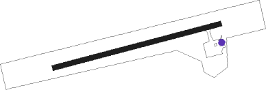
| Municipality | Wemindji (Land) |
| Elevation | 64ft (20m) |
| Timezone | GMT -5 |
| Coordinates | 53.01060, -78.83121 |
| Magnetic var | |
| Type | land |
| Available since | X-Plane v10.40 |
| ICAO code | CYNC |
| IATA code | YNC |
| FAA code | n/a |
Communication
| Wemindji APRT RDO | 122.100 |
Nearby beacons
| code | identifier | dist | bearing | frequency |
|---|---|---|---|---|
| YNC | WEMINDJI NDB | 0.2 | 106° | 385 |
| ZEM | EASTMAIN (EASTMAIN RIVER) NDB | 48.2 | 158° | 338 |
Instrument approach procedures
| runway | airway (heading) | route (dist, bearing) |
|---|---|---|
| RW10 | ILUXI (99°) | ILUXI ADVUP (5mi, 163°) 1700ft |
| RW10 | IRDER (67°) | IRDER ADVUP (5mi, 343°) 1700ft |
| RNAV | ADVUP 1700ft BIPDO (6mi, 84°) 1500ft CYNC (5mi, 84°) 80ft GOTAV (6mi, 84°) 1700ft GOTAV (turn) | |
| RW28 | SATEN (279°) | SATEN AXESA (5mi, 344°) 1700ft |
| RW28 | TARSI (247°) | TARSI AXESA (5mi, 164°) 1700ft |
| RNAV | AXESA 1700ft BOXUG (6mi, 264°) 1500ft REREN (2mi, 264°) 750ft CYNC (2mi, 264°) 116ft VITOR (6mi, 264°) 1700ft VITOR (turn) |
Disclaimer
The information on this website is not for real aviation. Use this data with the X-Plane flight simulator only! Data taken with kind consent from X-Plane 12 source code and data files. Content is subject to change without notice.