Peawanuck - Peawanuk
Airport details
| Country | Canada |
| State | Ontario |
| Region | CY |
| Airspace | Winnipeg Ctr |
| Municipality | Peawanuck |
| Elevation | 171ft (52m) |
| Timezone | GMT -5 |
| Coordinates | 54.98800, -85.44342 |
| Magnetic var | |
| Type | land |
| Available since | X-Plane v10.40 |
| ICAO code | CYPO |
| IATA code | YPO |
| FAA code | n/a |
Communication
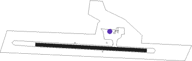
Runway info
| Runway 11 / 29 | ||
| length | 1071m (3514ft) | |
| bearing | 94° / 274° | |
| width | 30m (100ft) | |
| surface | gravel | |
Nearby beacons
| code | identifier | dist | bearing | frequency |
|---|---|---|---|---|
| YPO | PEAWANUCK NDB | 0.2 | 16° | 401 |
Instrument approach procedures
| runway | airway (heading) | route (dist, bearing) |
|---|---|---|
| RW11 | KEBEV (81°) | KEBEV ROMVI (5mi, 42°) 1500ft |
| RW11 | SENKO (109°) | SENKO ROMVI (5mi, 159°) 1500ft |
| RNAV | ROMVI 1500ft TESUB (6mi, 94°) 1500ft CYPO (4mi, 94°) 219ft UDMAV (5mi, 95°) 1500ft UDMAV (turn) | |
| RW29 | ALRUG (261°) | ALRUG VIKVO (5mi, 223°) 1500ft |
| RW29 | BOXOK (289°) | BOXOK VIKVO (5mi, 340°) 1500ft |
| RNAV | VIKVO 1500ft AVIXI (6mi, 275°) 1500ft CYPO (4mi, 275°) 217ft DUMKU (5mi, 274°) 1500ft DUMKU (turn) |
Disclaimer
The information on this website is not for real aviation. Use this data with the X-Plane flight simulator only! Data taken with kind consent from X-Plane 12 source code and data files. Content is subject to change without notice.