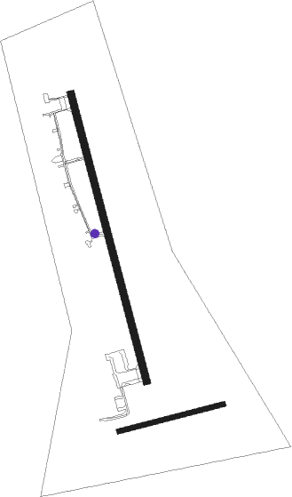
Muskoka
Airport details
| Country | Canada |
| State | Ontario |
| Region | CY |
| Airspace | Toronto Ctr |
| Municipality | Gravenhurst |
| Elevation | 923ft (281m) |
| Timezone | GMT -5 |
| Coordinates | 44.97507, -79.30376 |
| Magnetic var | |
| Type | land |
| Available since | X-Plane v10.40 |
| ICAO code | CYQA |
| IATA code | YQA |
| FAA code | n/a |
Communication
| Muskoka AWOS | 124.575 |
| Muskoka MF | 122.300 |
Nearby beacons
| code | identifier | dist | bearing | frequency |
|---|---|---|---|---|
| YEE | MIDLAND VOR/DME | 31.5 | 231° | 112.80 |
| YSO | DME | 44.5 | 170° | 117.35 |
| YPQ | PETERBOROUGH NDB | 58.2 | 132° | 379 |
| YMS | MANS (MANSFIELD) VOR/DME | 61.6 | 225° | 114.50 |
Instrument approach procedures
| runway | airway (heading) | route (dist, bearing) |
|---|---|---|
| RW18 | IGVIL (201°) | IGVIL SATEM (5mi, 263°) 2500ft |
| RW18 | LIBUN (133°) | LIBUN SATEM (5mi, 83°) 2500ft |
| RNAV | SATEM 2500ft OBNEP (5mi, 166°) 2490ft CYQA (5mi, 164°) 958ft TIDON (5mi, 168°) 2900ft TIDON (turn) | |
| RW36 | KETKU (314°) | KETKU SASOS (5mi, 263°) 2500ft |
| RW36 | PUTUX (22°) | PUTUX SASOS (5mi, 83°) 2500ft |
| RNAV | SASOS 2500ft IGSIM (5mi, 346°) 2500ft CYQA (5mi, 347°) 968ft NAKMO (5mi, 344°) 2900ft NAKMO (turn) |
Disclaimer
The information on this website is not for real aviation. Use this data with the X-Plane flight simulator only! Data taken with kind consent from X-Plane 12 source code and data files. Content is subject to change without notice.

