Comox
Airport details
| Country | Canada |
| State | British Columbia |
| Region | CY |
| Airspace | Vancouver Ctr |
| Municipality | Comox |
| Elevation | 83ft (25m) |
| Timezone | GMT -8 |
| Coordinates | 49.70928, -124.90176 |
| Magnetic var | |
| Type | land |
| Available since | X-Plane v10.40 |
| ICAO code | CYQQ |
| IATA code | YQQ |
| FAA code | n/a |
Communication
| Comox CYQQ ATIS | 118.600 |
| Comox COMOX CLD | 123.700 |
| Comox COMOX Ground Control | 119.750 |
| Comox COMOX Tower | 126.200 |
| Comox COMOX Approach | 128.100 |
| Comox COMOX Approach | 134.100 |
| Comox COMOX Departure | 123.700 |
Approach frequencies
| ILS-cat-I | RW30 | 109.75 | 18.00mi |
| ILS-cat-I | RW12 | 111.7 | 18.00mi |
| 3° GS | RW30 | 109.75 | 18.00mi |
| 3° GS | RW12 | 111.7 | 18.00mi |
Runway info
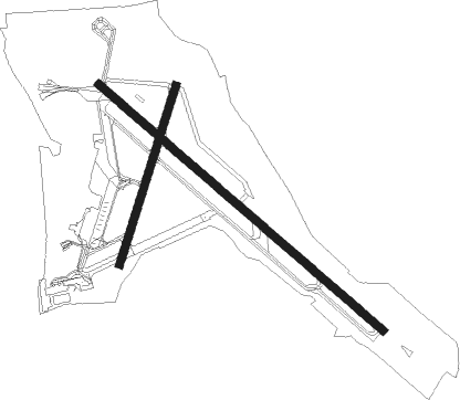
Runway 12 / 30  | ||
| length | 3045m (9990ft) | |
| bearing | 123° / 303° | |
| width | 61m (200ft) | |
| surface | concrete | |
| blast zone | 18m (59ft) / 10m (33ft) | |
| Runway 18 / 36 | ||
| length | 1517m (4977ft) | |
| bearing | 212° / 32° | |
| width | 61m (200ft) | |
| surface | asphalt | |
Nearby beacons
| code | identifier | dist | bearing | frequency |
|---|---|---|---|---|
| UQQ | COMOX TACAN | 0.3 | 67° | 110.40 |
| YPW | POWELL RIVER NDB | 17.3 | 72° | 382 |
| YBL | CAMPBELL RIVER NDB | 25 | 303° | 203 |
| YAZ | TOFINO NDB | 50.6 | 230° | 359 |
Departure and arrival routes
| Transition altitude | 18000ft |
| Transition level | 18000ft |
| SID end points | distance | outbound heading | |
|---|---|---|---|
| RW12 | |||
| OLELI1 | 53mi | 119° | |
| LENIL1 | 63mi | 303° | |
| RW30 | |||
| OLELI1 | 53mi | 119° | |
| LENIL1 | 63mi | 303° | |
| RW36 | |||
| OLELI1 | 53mi | 119° | |
| LENIL1 | 63mi | 303° | |
Instrument approach procedures
| runway | airway (heading) | route (dist, bearing) |
|---|---|---|
| RW12-Y | IGTAB (125°) | IGTAB 2000ft VOBOX (8mi, 123°) 1400ft |
| RW12-Y | SEBOV (256°) | SEBOV 6000ft TIGIN (7mi, 297°) 3700ft SEMVA (2mi, 278°) 3000ft VOBOX (4mi, 204°) 1400ft |
| RW12-Y | TEXIB (252°) | TEXIB 12000ft UBTOT (6mi, 261°) 10000ft OMIRU (12mi, 261°) 7000ft NUDUK (10mi, 261°) 4000ft SEMVA (3mi, 261°) 3000ft VOBOX (4mi, 204°) 1400ft |
| RNAV | VOBOX 1400ft CYQQ (4mi, 129°) 136ft (6709mi, 112°) 1100ft SELAG (6705mi, 292°) 2200ft SELAG (turn) | |
| RW12-Z | AGGUA (170°) | AGGUA KARIG (21mi, 220°) 5500ft BUBIR (6mi, 123°) 3600ft |
| RW12-Z | BOOPY (218°) | BOOPY SAXEN (19mi, 251°) 5700ft BUBIR (6mi, 237°) 3600ft |
| RW12-Z | DEGBI (283°) | DEGBI SAXEN (27mi, 303°) 5700ft BUBIR (6mi, 237°) 3600ft |
| RW12-Z | KELSY (123°) | KELSY IKBIS (20mi, 122°) 7500ft KARIG (23mi, 122°) 5500ft BUBIR (6mi, 123°) 3600ft |
| RW12-Z | MUZON (256°) | MUZON TEXIB (11mi, 269°) 12000ft UBTOT (6mi, 261°) 10000ft OMIRU (12mi, 261°) 7000ft SAXEN (17mi, 278°) 5700ft BUBIR (6mi, 237°) 3600ft |
| RW12-Z | OTNIX (77°) | OTNIX IKDIV (30mi, 76°) 18000ft MASUG (26mi, 47°) 9000ft KARIG (7mi, 57°) 5500ft BUBIR (6mi, 123°) 3600ft |
| RNAV | BUBIR 3600ft IGVIK (8mi, 123°) 2000ft EBLIB (4mi, 123°) 770ft CYQQ (3mi, 134°) 134ft (6709mi, 112°) 1000ft SELAG (6705mi, 292°) 2300ft SELAG (turn) | |
| RW18-Y | PUVAS (213°) | PUVAS 3000ft OVDEV (8mi, 213°) 1600ft ITKAP (2mi, 213°) 1400ft |
| RNAV | ITKAP 1400ft CYQQ (5mi, 214°) 128ft (6709mi, 112°) 600ft SELAG (6705mi, 292°) 2200ft SELAG (turn) | |
| RW30-Y | AXITI (289°) | AXITI 6000ft OTESO (12mi, 284°) 2100ft OLUNI (1mi, 293°) 1700ft |
| RW30-Y | TEXIB (252°) | TEXIB 12000ft MEGED (6mi, 239°) 10000ft RIGOS (9mi, 239°) 7000ft NOVUV (9mi, 239°) 4000ft KITEV (3mi, 239°) 3100ft OTESO (3mi, 263°) 2100ft OLUNI (1mi, 293°) 1700ft |
| RW30-Y | UKTAM (301°) | UKTAM 2200ft OLUNI (6mi, 303°) 1700ft |
| RNAV | OLUNI 1700ft CYQQ (6mi, 299°) 144ft (6709mi, 112°) 1100ft AXOGI (6709mi, 292°) 2300ft AXOGI (turn) | |
| RW30-Z | ITMAV (288°) | ITMAV ODKOD (15mi, 274°) 5100ft ROGSO (5mi, 304°) 3200ft |
| RW30-Z | MUZON (256°) | MUZON TEXIB (11mi, 269°) 12000ft MEGED (6mi, 239°) 10000ft RIGOS (9mi, 239°) 7000ft DEGBI (10mi, 215°) 3700ft ROGSO (6mi, 237°) 3200ft |
| RW30-Z | NANOO (304°) | NANOO ODKOD (19mi, 306°) 5100ft ROGSO (5mi, 304°) 3200ft |
| RW30-Z | OTNIX (77°) | OTNIX IKDIV (30mi, 76°) 18000ft TAPGU (42mi, 95°) 8200ft ODKOD (7mi, 57°) 5100ft ROGSO (5mi, 304°) 3200ft |
| RW30-Z | SAXEN (151°) | SAXEN DEGBI (27mi, 123°) 3700ft ROGSO (6mi, 237°) 3200ft |
| RNAV | ROGSO 3200ft VIGBU (6mi, 303°) 2000ft CYQQ (7mi, 300°) 144ft (6709mi, 112°) 1000ft AXOGI (6709mi, 292°) 2200ft AXOGI (turn) |
Disclaimer
The information on this website is not for real aviation. Use this data with the X-Plane flight simulator only! Data taken with kind consent from X-Plane 12 source code and data files. Content is subject to change without notice.