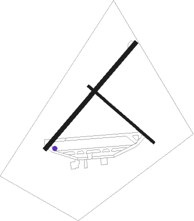
Yorkton - Yorkton Muni
Airport details
| Country | Canada |
| State | Saskatchewan |
| Region | CY |
| Airspace | Winnipeg Ctr |
| Municipality | Yorkton |
| Elevation | 1631ft (497m) |
| Timezone | GMT -6 |
| Coordinates | 51.26480, -102.46132 |
| Magnetic var | |
| Type | land |
| Available since | X-Plane v10.40 |
| ICAO code | CYQV |
| IATA code | YQV |
| FAA code | n/a |
Communication
| Yorkton Muni MF EDMONTON RDO | 122.200 |
Nearby beacons
| code | identifier | dist | bearing | frequency |
|---|---|---|---|---|
| YQV | YORKTON VOR/DME | 0.2 | 264° | 115.80 |
| YDR | BROADVIEW VOR/DME | 54.2 | 185° | 117.50 |
Instrument approach procedures
| runway | airway (heading) | route (dist, bearing) |
|---|---|---|
| RW04 | KEGTU (77°) | KEGTU TOXOM (5mi, 122°) 3400ft |
| RW04 | OMPID (30°) | OMPID TOXOM (5mi, 302°) 3400ft |
| RNAV | TOXOM 3400ft PEMKU (6mi, 58°) 3000ft NOXUK (2mi, 58°) 2260ft CYQV (2mi, 58°) 1685ft IMOVU (5mi, 58°) 3400ft IMOVU (turn) 3400ft | |
| RW22 | ONGUP (210°) | ONGUP XOTAV (5mi, 122°) 3100ft |
| RW22 | UBVIB (257°) | UBVIB XOTAV (5mi, 302°) 3100ft |
| RNAV | XOTAV 3100ft VEPNI (6mi, 238°) 3000ft CYQV (5mi, 238°) 1647ft PUVUM (5mi, 238°) 3400ft PUVUM (turn) 3400ft |
Disclaimer
The information on this website is not for real aviation. Use this data with the X-Plane flight simulator only! Data taken with kind consent from X-Plane 12 source code and data files. Content is subject to change without notice.

