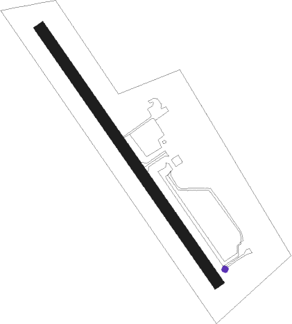
Quesnel
Airport details
| Country | Canada |
| State | British Columbia |
| Region | CY |
| Airspace | Vancouver Ctr |
| Municipality | Quesnel |
| Elevation | 1789ft (545m) |
| Timezone | GMT -8 |
| Coordinates | 53.02608, -122.51037 |
| Magnetic var | |
| Type | land |
| Available since | X-Plane v10.40 |
| ICAO code | CYQZ |
| IATA code | YQZ |
| FAA code | n/a |
Communication
| QUESNEL AWOS | 124.400 |
| QUESNEL WILLIAMS LAKE RDO | 122.200 |
Nearby beacons
| code | identifier | dist | bearing | frequency |
|---|---|---|---|---|
| XS | PRINCE GEORGE NDB | 48.4 | 350° | 272 |
| YWL | WILLIAMS LAKE VOR/DME | 48.9 | 157° | 113.60 |
| YXS | PRINCE GEORGE VOR/DME | 52.1 | 4° | 112.30 |
| ZXS | NORTHWOOD (PRINCE GEORGE) NDB | 56.9 | 349° | 260 |
Departure and arrival routes
| Transition altitude | 18000ft |
| Transition level | 18000ft |
| SID end points | distance | outbound heading | |
|---|---|---|---|
| RW31 | |||
| XORUD3 | 19mi | 300° | |
Instrument approach procedures
| runway | airway (heading) | route (dist, bearing) |
|---|---|---|
| RW13-Y | DASGA (134°) | DASGA UKTAN (6mi, 133°) 4900ft |
| RW13-Y | KAVUG (171°) | KAVUG UKTAN (6mi, 249°) 4900ft |
| RW13-Y | ONDOX (110°) | ONDOX UKTAN (6mi, 69°) 4900ft |
| RNAV | UKTAN 4900ft ELVUG (6mi, 133°) 3900ft LETOD (3mi, 133°) 2940ft PEMSO (3mi, 134°) 1838ft (6538mi, 113°) 2700ft VIPNO (6540mi, 293°) 6900ft VIPNO (turn) | |
| RW13-Z | IRLEV (169°) | IRLEV UKUSO (5mi, 251°) 5300ft |
| RW13-Z | OTROD (113°) | OTROD UKUSO (5mi, 71°) 5300ft |
| RW13-Z | VINBA (136°) | VINBA UKUSO (5mi, 135°) 5300ft |
| RNAV | UKUSO 5300ft XORGA (6mi, 136°) 3500ft GOXOT (2mi, 136°) 2870ft CYQZ (3mi, 136°) 1828ft KEPSU (5mi, 136°) IMOVI (10mi, 199°) 6000ft IMOVI (turn) | |
| RW31-Y | ADVAL (316°) | ADVAL IKDEP (6mi, 316°) 5800ft |
| RW31-Y | MERSO (297°) | MERSO IKDEP (6mi, 251°) 5800ft |
| RW31-Y | PIKLU (343°) | PIKLU IKDEP (6mi, 70°) 5800ft |
| RNAV | IKDEP 5800ft BOLTU (6mi, 316°) 5300ft ITGAB (turn) 4900ft DULPO (4mi, 316°) 3420ft CYQZ (5mi, 316°) 1821ft SEGUB (10mi, 305°) 6900ft SEGUB (turn) | |
| RW31-Z | AIRIE (70°) | AIRIE USBOB (18mi, 98°) 7100ft LOURN (16mi, 77°) 5900ft |
| RW31-Z | DEKSI (316°) | DEKSI LOURN (3mi, 316°) 6200ft |
| RW31-Z | LIDUL (262°) | LIDUL RUNNY (17mi, 125°) 6500ft LOURN (11mi, 263°) 6500ft |
| RNAV | LOURN 5900ft ATHON (7mi, 316°) 5000ft UKINA (3mi, 316°) 3800ft CYQZ (5mi, 316°) 1821ft OMISA (8mi, 316°) 5400ft OMISA (turn) |
Disclaimer
The information on this website is not for real aviation. Use this data with the X-Plane flight simulator only! Data taken with kind consent from X-Plane 12 source code and data files. Content is subject to change without notice.
