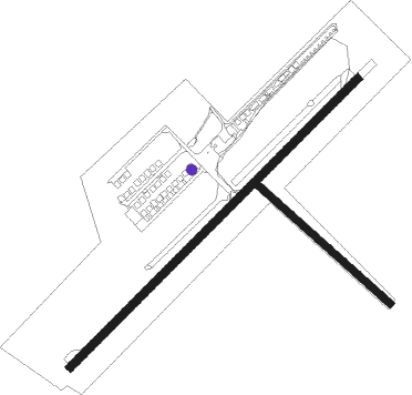
Smiths Falls - Smiths Falls/montague
Airport details
| Country | Canada |
| State | Ontario |
| Region | CY |
| Airspace | Montreal Ctr |
| Municipality | Montague |
| Elevation | 416ft (127m) |
| Timezone | GMT -5 |
| Coordinates | 44.94584, -75.94028 |
| Magnetic var | |
| Type | land |
| Available since | X-Plane v10.40 |
| ICAO code | CYSH |
| IATA code | YSH |
| FAA code | n/a |
Communication
| Smiths Falls/Montague CTAF | 122.700 |
Nearby beacons
| code | identifier | dist | bearing | frequency |
|---|---|---|---|---|
| OG | OGIVE (OGDENSBURG) NDB | 29 | 113° | 358 |
| OW | OTTAWA NDB | 29.6 | 42° | 236 |
| YOW | OTTAWA VOR/DME | 29.8 | 5° | 114.60 |
| YGK | KINGSTON NDB | 48.2 | 226° | 263 |
| ART | WATERTOWN VORTAC | 59.9 | 187° | 109.80 |
Instrument approach procedures
| runway | airway (heading) | route (dist, bearing) |
|---|---|---|
| RW06 | MUROM (81°) | MUROM IMIRU (5mi, 130°) 1800ft |
| RW06 | TUGUX (28°) | TUGUX IMIRU (5mi, 310°) 1800ft |
| RNAV | IMIRU 1800ft VIPSI (5mi, 59°) 1700ft SEGES (3mi, 59°) 629ft KEVLA (5mi, 59°) 2300ft KEVLA (turn) | |
| RW24 | LOBLO (264°) | LOBLO VOGAN (5mi, 310°) 1600ft |
| RW24 | RODBI (204°) | RODBI VOGAN (5mi, 130°) 1600ft |
| RNAV | VOGAN 1600ft SEAFO (5mi, 239°) 1380ft CYSH (3mi, 239°) 457ft JANOW (9mi, 239°) 2300ft JANOW (turn) |
Disclaimer
The information on this website is not for real aviation. Use this data with the X-Plane flight simulator only! Data taken with kind consent from X-Plane 12 source code and data files. Content is subject to change without notice.

