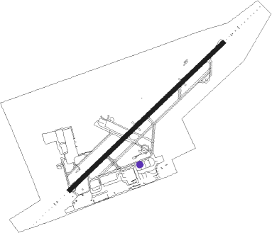
Trenton - Cfb Trenton
Airport details
| Country | Canada |
| State | Ontario |
| Region | CY |
| Airspace | Toronto Ctr |
| Municipality | Quinte West |
| Elevation | 283ft (86m) |
| Timezone | GMT -5 |
| Coordinates | 44.11889, -77.52805 |
| Magnetic var | |
| Type | land |
| Available since | X-Plane v10.40 |
| ICAO code | CYTR |
| IATA code | YTR |
| FAA code | n/a |
Communication
| CFB Trenton ATIS | 135.450 |
| CFB Trenton Clearance DEL | 124.350 |
| CFB Trenton Ground Control | 121.900 |
| CFB Trenton unnamed entity | 128.800 |
| CFB Trenton Tower | 128.700 |
| CFB Trenton Approach/Departure | 128.400 |
Approach frequencies
| ILS-cat-I | RW06 | 110.75 | 18.00mi |
| ILS-cat-I | RW24 | 109.7 | 18.00mi |
| 3° GS | RW06 | 110.75 | 18.00mi |
| 3° GS | RW24 | 109.7 | 18.00mi |
Nearby beacons
| code | identifier | dist | bearing | frequency |
|---|---|---|---|---|
| UTR | TRENTON TACAN | 0.1 | 341° | 109.70 |
| ZZR | SEVERN (TRENTON) NDB | 5.8 | 236° | 317 |
| YTR | TRENTON NDB | 6.9 | 59° | 215 |
| YCF | DME | 14.9 | 321° | 113.50 |
| VIE | COEHILL VOR/DME | 36 | 326° | 115.10 |
| YPQ | PETERBOROUGH NDB | 40.6 | 276° | 379 |
| YGK | KINGSTON NDB | 41.1 | 79° | 263 |
Instrument approach procedures
| runway | airway (heading) | route (dist, bearing) |
|---|---|---|
| RW06 | OBRAB (79°) | OBRAB XORIG (5mi, 131°) 2200ft |
| RW06 | OVOSU (34°) | OVOSU XORIG (5mi, 311°) 2200ft |
| RW06 | PUSUK (59°) | PUSUK XORIG (5mi, 59°) 2200ft |
| RNAV | XORIG 2200ft GOVIR (5mi, 59°) 1920ft FROTS (2mi, 59°) 1280ft CYTR (4mi, 60°) 325ft AXAVO (10mi, 60°) 3000ft AXAVO (turn) | |
| RW24 | BOVOD (240°) | BOVOD DUTEV (5mi, 240°) 2300ft |
| RW24 | EPSEP (216°) | EPSEP DUTEV (5mi, 131°) 2300ft |
| RW24 | IKBOG (258°) | IKBOG DUTEV (5mi, 311°) 2300ft |
| RNAV | DUTEV 2300ft XUDAD (6mi, 240°) 1920ft ODGOX (2mi, 240°) 1130ft CYTR (3mi, 239°) 333ft IKDUN (14mi, 239°) 2800ft IKDUN (turn) |
Disclaimer
The information on this website is not for real aviation. Use this data with the X-Plane flight simulator only! Data taken with kind consent from X-Plane 12 source code and data files. Content is subject to change without notice.
