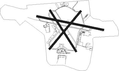
Victoria - Victoria Intl
Airport details
| Country | Canada |
| State | British Columbia |
| Region | CY |
| Airspace | Vancouver Ctr |
| Municipality | North Saanich |
| Elevation | 55ft (17m) |
| Timezone | GMT -8 |
| Coordinates | 48.64704, -123.43197 |
| Magnetic var | |
| Type | land |
| Available since | X-Plane v10.40 |
| ICAO code | CYYJ |
| IATA code | YYJ |
| FAA code | n/a |
Communication
| Victoria Intl ATIS | 118.800 |
| Victoria Intl CLR | 126.400 |
| Victoria Intl Tower | 119.700 |
| Victoria Intl Ground Control | 121.900 |
| Victoria Intl Departure | 133.850 |
Approach frequencies
| ILS-cat-I | RW09 | 108.7 | 18.00mi |
| ILS-cat-I | RW27 | 109.95 | 18.00mi |
| 3° GS | RW09 | 108.7 | 18.00mi |
| 3° GS | RW27 | 109.95 | 18.00mi |
Nearby Points of Interest:
1114 Arthur Currie Lane
-Hatley Park National Historic Site
-Bay Street Substation
-CFB Esquimalt
-Esquimalt and Nanaimo Railway Roundhouse
-Hook Sin Tong Charity Building
-On Hing Building
-On Hing & Brothers Store
-Chinese Consolidated Benevolent Association Building
-Chinatown
-Chinese Consolidated Benevolent Association and Chinese Public School
-Hudson's Bay Company Department Store
-Gee Tuck Tong Benevolent Association Building
-Lim Dat Building
-Loo Tai Cho Building
-Masonic Temple
-Lee Woy & Company Building
-Ning Young Building
-Fairfield Block
-City Hall Annex
-Milne Block
-Victoria City Hall, British Columbia
-Morley's Soda Water Factory
-H. Saunders Grocery and Liquor Store
-Prior Building
Runway info
Runway 09 / 27  | ||
| length | 2124m (6969ft) | |
| bearing | 101° / 281° | |
| width | 61m (200ft) | |
| surface | asphalt | |
| Runway 14 / 32 | ||
| length | 1521m (4990ft) | |
| bearing | 141° / 321° | |
| width | 61m (200ft) | |
| surface | asphalt | |
| displ threshold | 130m (427ft) / 0m (0ft) | |
| Runway 03 / 21 | ||
| length | 1530m (5020ft) | |
| bearing | 56° / 236° | |
| width | 61m (200ft) | |
| surface | asphalt | |
| displ threshold | 431m (1414ft) / 268m (879ft) | |
Nearby beacons
| code | identifier | dist | bearing | frequency |
|---|---|---|---|---|
| YJ | VICTORIA NDB | 1.3 | 96° | 200 |
| MB | MILL BAY (VICTORIA) NDB | 4.4 | 283° | 293 |
| YYJ | VICTORIA VOR/DME | 5.2 | 327° | 113.70 |
| AP | ACTIVE PASS NDB | 14.7 | 32° | 378 |
| FHR | FRIDAY HARBOR NDB | 18.1 | 108° | 284 |
| YVR | VANCOUVER VOR/DME | 28.1 | 33° | 115.90 |
| NOW | EDIZ HOOK (PORT ANGELES) NDB | 30.4 | 177° | 338 |
| CL | ELWHA (PORT ANGELES) NDB | 31.3 | 206° | 515 |
| YCD | NANAIMO NDB | 33.6 | 318° | 251 |
| WC | WHITE ROCK NDB | 34.4 | 62° | 332 |
| VR | VANCOUVER NDB | 34.8 | 35° | 266 |
| NUW | WHIDBEY ISLAND (OAK HARBO TACAN | 35.3 | 111° | 113.80 |
| CVV | PENN COVE VOR/DME | 37.1 | 120° | 117.20 |
| HUH | WHATCOM VORTAC | 38.1 | 71° | 113 |
| XX | ABBOTSFORD NDB | 43.3 | 69° | 344 |
| YPK | PITT MEADOWS VOR | 44.3 | 52° | 112.40 |
Departure and arrival routes
| Transition altitude | 18000ft |
| Transition level | 18000ft |
| SID end points | distance | outbound heading | |
|---|---|---|---|
| RW03 | |||
| CYYJ5 | 13mi | 281° | |
| RW09 | |||
| CYYJ5 | 13mi | 281° | |
| RW14 | |||
| CYYJ5 | 13mi | 281° | |
| RW27 | |||
| MB8 | 28mi | 33° | |
| RW32 | |||
| CLOAK6, MB8 | 28mi | 33° | |
| STAR starting points | distance | inbound heading | |
|---|---|---|---|
| RW09 | |||
| DISCO4 | 17.9 | 314° | |
| RW27 | |||
| DISCO4 | 17.9 | 314° | |
Instrument approach procedures
| runway | airway (heading) | route (dist, bearing) |
|---|---|---|
| RW09-X | DAXET (124°) | DAXET AGBAR (5mi, 203°) 3100ft |
| RW09-X | LIDIS (77°) | LIDIS IKLAG (4mi, 23°) 3800ft AGBAR (3mi, 23°) 3100ft |
| RNAV | AGBAR 3100ft NADEP (4mi, 101°) 2100ft CYYJ (6mi, 102°) 103ft (6687mi, 112°) 3000ft AP (6676mi, 292°) 3000ft AP (turn) | |
| RW09-Z | DAXET (124°) | DAXET AGBAR (5mi, 203°) 3100ft |
| RW09-Z | LIDIS (77°) | LIDIS IKLAG (4mi, 23°) 3800ft AGBAR (3mi, 23°) 3100ft |
| RNAV | AGBAR 3100ft NADEP (4mi, 101°) 2100ft XOVIK (2mi, 101°) 1200ft CYYJ (3mi, 103°) 103ft (6687mi, 112°) 3000ft AP (6676mi, 292°) 3000ft AP (turn) | |
| RW27-Z | OBSOP (264°) | OBSOP LAFFO (5mi, 204°) 2300ft |
| RW27-Z | UKNUP (296°) | UKNUP LAFFO (5mi, 6°) 2300ft |
| RNAV | LAFFO 2300ft TUGUK (4mi, 281°) 2200ft XOTAN (4mi, 281°) 1010ft CYYJ (4mi, 279°) 116ft APKOS (9mi, 282°) ITPIV (9mi, 23°) 3500ft AP (12mi, 83°) AP (turn) |
Holding patterns
| STAR name | hold at | type | turn | heading* | altitude | leg | speed limit |
|---|---|---|---|---|---|---|---|
| APASS6 | KELKU | VHF | right | 89 (269)° | 1.0min timed | 175 | |
| APASS6 | OBSOP | VHF | left | 269 (89)° | 1.0min timed | 200 | |
| DISCO4 | OMINU | VHF | left | 99 (279)° | 1.0min timed | 210 | |
| FASBO6 | EPSOK | VHF | right | 90 (270)° | > 4000ft | 1.0min timed | 175 |
| FASBO6 | KAVSA | VHF | left | 268 (88)° | > 3000ft | 1.0min timed | 200 |
| *) magnetic outbound (inbound) holding course | |||||||
Disclaimer
The information on this website is not for real aviation. Use this data with the X-Plane flight simulator only! Data taken with kind consent from X-Plane 12 source code and data files. Content is subject to change without notice.