Bromont - Aeroport Roland Desourdy
Airport details
| Country | Canada |
| State | Quebec |
| Region | CY |
| Airspace | Montreal Ctr |
| Municipality | Bromont |
| Elevation | 370ft (113m) |
| Timezone | GMT -5 |
| Coordinates | 45.29094, -72.74197 |
| Magnetic var | |
| Type | land |
| Available since | X-Plane v10.30 |
| ICAO code | CZBM |
| IATA code | ZBM |
| FAA code | n/a |
Communication
| Aeroport Roland Desourdy MONTREAL CTR | 132.550 |
| Aeroport Roland Desourdy CTAF/UNICOM | 122.150 |
Nearby Points of Interest:
Farnham, Quebec railway station
-Église universaliste de Waterloo
-Église Saint-Luke de Waterloo
-Moulin à eau de la Grande Barbue
-Église anglicane Saint-Paul
-Grange Alexander-Solomon-Walbridge
-Bolton-Est Town Hall
-Sheldon Boright House
-St. Ann's Episcopal Church
-Missisquoi River Bridge
-Richford Primary School
-Sweat-Comings Company House
-West Berkshire School
-Maison natale Honoré-Mercier
-Fort Saint-Jean
-Saint-Jean-sur-Richelieu railway station
-Fort Sainte Thérèse
-Four à pain Dupuis
-Enosburg Opera House
-Billado Block
-Maison Thomas-Whitehead
-Montgomery House
-De Salaberry House
-St. Stephen's Church
-Enosburg Congregational Memorial Church
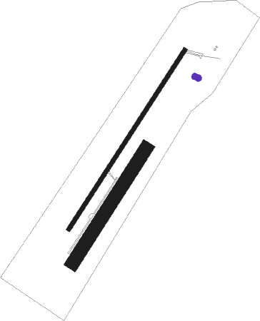
Runway info
Runway 05 / 23  | ||
| length | 1527m (5010ft) | |
| bearing | 47° / 227° | |
| width | 30m (100ft) | |
| surface | asphalt | |
| blast zone | 60m (197ft) / 0m (0ft) | |
| Runway 05R / 23L | ||
| length | 968m (3176ft) | |
| bearing | 47° / 227° | |
| width | 97m (319ft) | |
| surface | grass | |
| blast zone | 0m (0ft) / 1m (3ft) | |
Nearby beacons
| code | identifier | dist | bearing | frequency |
|---|---|---|---|---|
| YJN | DME | 24.5 | 267° | 115.80 |
| ZHU | HAUTS-BOIS (MONTREAL) NDB | 30.3 | 294° | 407 |
| Y8 | DRUMMONDVILLE NDB | 36.3 | 32° | 401 |
| YSC | DME | 40.3 | 88° | 113.20 |
| BT | HERRO (BURLINGTON) NDB | 50.4 | 214° | 382 |
| BJA | BURLINGTON TACAN | 51.9 | 207° | 112.40 |
| BTV | BURLINGTON VOR/DME | 56.8 | 206° | 117.50 |
Instrument approach procedures
| runway | airway (heading) | route (dist, bearing) |
|---|---|---|
| RW05 | ANSYL (68°) | ANSYL IMUXI (4mi, 110°) 2900ft |
| RW05 | ENEBO (13°) | ENEBO IMUXI (5mi, 298°) 2900ft |
| RNAV | IMUXI 2900ft IKBAV (5mi, 47°) 1700ft XOTMI (2mi, 47°) 900ft CZBM (2mi, 47°) 395ft IGVEB (10mi, 32°) 3100ft IGVEB (turn) | |
| RW23 | HAFIZ (193°) | HAFIZ ELBES (5mi, 114°) 2900ft |
| RW23 | LIBUV (245°) | LIBUV ELBES (5mi, 294°) 2500ft |
| RNAV | ELBES 2500ft MACVL (6mi, 222°) 2200ft XOVPU (3mi, 222°) 1000ft CZBM (2mi, 223°) 425ft ILILA (8mi, 222°) 3100ft ILILA (turn) |
Disclaimer
The information on this website is not for real aviation. Use this data with the X-Plane flight simulator only! Data taken with kind consent from X-Plane 12 source code and data files. Content is subject to change without notice.