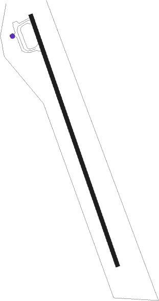
108 Mile - South Cariboo Regional/108 Mile Airport
Airport details
| Country | Canada |
| State | British Columbia |
| Region | CY |
| Airspace | Vancouver Ctr |
| Municipality | Area G (Lac La Hache/108 Mile Ranch) |
| Elevation | 3083ft (940m) |
| Timezone | GMT -8 |
| Coordinates | 51.73660, -121.33289 |
| Magnetic var | |
| Type | land |
| Available since | X-Plane v10.40 |
| ICAO code | CZML |
| IATA code | ZMH |
| FAA code | n/a |
Communication
| South Cariboo Regional/108 Mile Airport VANCOUVER CNTR | 134.000 |
| South Cariboo Regional/108 Mile Airport CTAF | 123.200 |
Nearby beacons
| code | identifier | dist | bearing | frequency |
|---|---|---|---|---|
| YWL | WILLIAMS LAKE VOR/DME | 43.1 | 301° | 113.60 |
Departure and arrival routes
| Transition altitude | 18000ft |
| Transition level | 18000ft |
| SID end points | distance | outbound heading | |
|---|---|---|---|
| RW15 | |||
| MIBTI2 | 18mi | 158° | |
| ALTAG2 | 18mi | 290° | |
| RW33 | |||
| MIBTI2 | 18mi | 158° | |
| ALTAG2 | 18mi | 290° | |
Instrument approach procedures
| runway | airway (heading) | route (dist, bearing) |
|---|---|---|
| RW15 | ALTAG (110°) | ALTAG DANIT (11mi, 88°) 4900ft |
| RNAV | DANIT 4900ft GABOP (5mi, 137°) 4800ft CZML (5mi, 157°) 3176ft VILDO (2mi, 157°) 6600ft MIBTI (17mi, 158°) MIBTI (turn) | |
| RW33 | LORVO (59°) | LORVO BOGSA (14mi, 84°) 5600ft ELITA (5mi, 81°) 5300ft |
| RW33 | MIBTI (338°) | MIBTI ELITA (7mi, 339°) 5300ft |
| RNAV | ELITA 5300ft KAREK (6mi, 337°) 4900ft LIBAX (3mi, 337°) 3850ft CZML (2mi, 337°) 3144ft ALTAG (18mi, 290°) 6100ft ALTAG (turn) |
Disclaimer
The information on this website is not for real aviation. Use this data with the X-Plane flight simulator only! Data taken with kind consent from X-Plane 12 source code and data files. Content is subject to change without notice.
