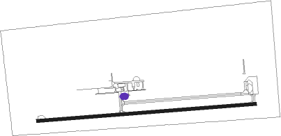
Pincher Creek
Airport details
| Country | Canada |
| State | Alberta |
| Region | CY |
| Airspace | Edmonton Ctr |
| Municipality | Municipal District of Pincher Creek No. |
| Elevation | 3901ft (1189m) |
| Timezone | GMT -7 |
| Coordinates | 49.52043, -113.99710 |
| Magnetic var | |
| Type | land |
| Available since | X-Plane v10.40 |
| ICAO code | CZPC |
| IATA code | WPC |
| FAA code | n/a |
Communication
| Pincher Creek AWOS | 127.650 |
| Pincher Creek Traffic | 123.200 |
Nearby beacons
| code | identifier | dist | bearing | frequency |
|---|---|---|---|---|
| 9Y | PINCHER CREEK NDB | 0.1 | 333° | 311 |
| Z7 | CLARESHOLM INDUSTRIAL NDB | 32.1 | 37° | 408 |
Instrument approach procedures
| runway | airway (heading) | route (dist, bearing) |
|---|---|---|
| RW08 | APKUK (111°) | APKUK NABAV (7mi, 180°) 7300ft |
| RW08 | PEVBI (68°) | PEVBI NABAV (7mi, 360°) 7300ft |
| RNAV | NABAV 7300ft RIDIM (3mi, 90°) 6600ft LEXAL (2mi, 90°) 6200ft DURPU (4mi, 90°) 4560ft CZPC (2mi, 90°) 3950ft ODBOT (5mi, 90°) 6000ft ODBOT (turn) 6000ft | |
| RW26 | LORGU (294°) | LORGU DUTBA (8mi, 0°) 7000ft |
| RW26 | OTNUR (246°) | OTNUR DUTBA (8mi, 180°) 7000ft |
| RW26 | YQL (265°) | YQL RAGAB (33mi, 262°) 7000ft DUTBA (8mi, 270°) 7000ft |
| RNAV | DUTBA 7000ft APDEV (6mi, 270°) 5600ft CZPC (6mi, 270°) 3930ft (6325mi, 113°) 5000ft DUTBA (6314mi, 294°) 7500ft DUTBA (turn) |
Disclaimer
The information on this website is not for real aviation. Use this data with the X-Plane flight simulator only! Data taken with kind consent from X-Plane 12 source code and data files. Content is subject to change without notice.
