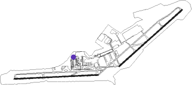
Algiers - Houari Boumediene
Airport details
| Country | Algeria |
| State | Algiers |
| Region | DA |
| Airspace | Algiers Ctr |
| Municipality | Dar El Beïda |
| Elevation | 81ft (25m) |
| Timezone | GMT +1 |
| Coordinates | 36.70217, 3.22239 |
| Magnetic var | |
| Type | land |
| Available since | X-Plane v10.40 |
| ICAO code | DAAG |
| IATA code | ALG |
| FAA code | n/a |
Communication
| Houari Boumediene ALGER | 128.525 |
| Houari Boumediene ALGER Ground Control | 121.800 |
| Houari Boumediene ALGER Tower | 118.700 |
| Houari Boumediene ALGER Approach | 121.400 |
Approach frequencies
| ILS-cat-III | RW23 | 110.3 | 18.00mi |
| ILS-cat-II | RW09 | 108.5 | 18.00mi |
| ILS-cat-I | RW27 | 109.5 | 18.00mi |
| 3° GS | RW23 | 110.3 | 18.00mi |
| 3° GS | RW27 | 109.5 | 18.00mi |
| 3° GS | RW09 | 108.5 | 18.00mi |
Nearby beacons
| code | identifier | dist | bearing | frequency |
|---|---|---|---|---|
| ALR | DAR EL BEIDA VOR/DME | 0.7 | 212° | 112.50 |
| HBM | ALGIERS VOR | 3.2 | 101° | 117.05 |
| SMR | SEMAR NDB | 6.4 | 266° | 370 |
| OA | REGHAIA (ALGIERS) NDB | 8.2 | 61° | 342 |
| SDM | SIDI M'HAMED (ALGIERS) VOR/DME | 12.7 | 254° | 113.90 |
| ZEM | ZEMMOURI VOR/DME | 17.6 | 75° | 116.60 |
| ZEM | ZEMMOURI NDB | 17.7 | 75° | 359 |
| BNA | BENI AMRANE NDB | 18 | 98° | 353 |
| MAR | MARMORA NDB | 21.2 | 268° | 416 |
Departure and arrival routes
| Transition altitude | 3937ft |
| SID end points | distance | outbound heading | |
|---|---|---|---|
| RW05 | |||
| PECE1C | 196mi | 17° | |
| OTAR1C | 154mi | 32° | |
| BOUR1C | 115mi | 54° | |
| BJA1C | 89mi | 90° | |
| BABO1C | 87mi | 97° | |
| TAGR1C | 91mi | 106° | |
| BSA1G, BSA1C | 95mi | 143° | |
| CHE1C | 116mi | 232° | |
| LABR1C | 106mi | 285° | |
| SADA1C, MOGI1C | 166mi | 350° | |
| RW09 | |||
| PECE1D | 196mi | 17° | |
| OTAR1D | 154mi | 32° | |
| BOUR1D | 115mi | 54° | |
| BJA1D | 89mi | 90° | |
| BABO1D | 87mi | 97° | |
| TAGR1D | 91mi | 106° | |
| BSA1D, BSA1H | 95mi | 143° | |
| CHE1D | 116mi | 232° | |
| LABR1D | 106mi | 285° | |
| MOGI1D, SADA1D | 166mi | 350° | |
| RW23 | |||
| PECE1A | 196mi | 17° | |
| OTAR1A | 154mi | 32° | |
| BOUR1A | 115mi | 54° | |
| BJA1A | 89mi | 90° | |
| BABO1A | 87mi | 97° | |
| TAGR1A | 91mi | 106° | |
| BSA1E, BSA1A | 95mi | 143° | |
| CHE1A | 116mi | 232° | |
| LABR1A | 106mi | 285° | |
| MOGI1A, SADA1A | 166mi | 350° | |
| RW27 | |||
| PECE1B | 196mi | 17° | |
| OTAR1B | 154mi | 32° | |
| BOUR1B | 115mi | 54° | |
| BJA1B | 89mi | 90° | |
| BABO1B | 87mi | 97° | |
| TAGR1B | 91mi | 106° | |
| BSA1B, BSA1F | 95mi | 143° | |
| CHE1B | 116mi | 232° | |
| LABR1B | 106mi | 285° | |
| MOGI1B, SADA1B | 166mi | 350° | |
Disclaimer
The information on this website is not for real aviation. Use this data with the X-Plane flight simulator only! Data taken with kind consent from X-Plane 12 source code and data files. Content is subject to change without notice.

