Tébessi - Cheikh Larbi Tebessi
Airport details
| Country | Algeria |
| State | Tébessa |
| Region | DA |
| Airspace | Algiers Ctr |
| Municipality | Tebessa |
| Elevation | 2661ft (811m) |
| Timezone | GMT +1 |
| Coordinates | 35.43264, 8.12560 |
| Magnetic var | |
| Type | land |
| Available since | X-Plane v11.51r1 |
| ICAO code | DABS |
| IATA code | TEE |
| FAA code | n/a |
Communication
| Cheikh Larbi Tebessi TEBESSA Tower | 118.100 |
| Cheikh Larbi Tebessi TEBESSA Tower | 119.700 |
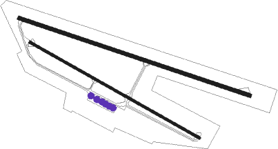
Runway info
Runway 11 / 29  | ||
| length | 3001m (9846ft) | |
| bearing | 109° / 289° | |
| width | 45m (148ft) | |
| surface | asphalt | |
| blast zone | 105m (344ft) / 105m (344ft) | |
| Runway 12 / 30 | ||
| length | 2403m (7884ft) | |
| bearing | 119° / 299° | |
| width | 30m (98ft) | |
| surface | asphalt | |
| blast zone | 0m (0ft) / 90m (295ft) | |
Nearby beacons
| code | identifier | dist | bearing | frequency |
|---|---|---|---|---|
| TBS | TEBESSA VOR/DME | 3.1 | 293° | 114.50 |
Disclaimer
The information on this website is not for real aviation. Use this data with the X-Plane flight simulator only! Data taken with kind consent from X-Plane 12 source code and data files. Content is subject to change without notice.