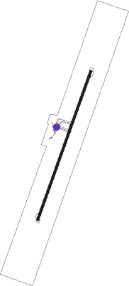
Akure
Airport details
| Country | Nigeria |
| State | Ondo State |
| Region | DN |
| Airspace | Kano Ctr |
| Municipality | Akure North |
| Elevation | 1100ft (335m) |
| Timezone | GMT +1 |
| Coordinates | 7.24674, 5.30098 |
| Magnetic var | |
| Type | land |
| Available since | X-Plane v10.30 |
| ICAO code | DNAK |
| IATA code | AKR |
| FAA code | n/a |
Communication
| Akure Tower | 118.200 |
Nearby Points of Interest:
Idanre Hill
Runway info
| Runway 03 / 21 | ||
| length | 2814m (9232ft) | |
| bearing | 24° / 204° | |
| width | 45m (148ft) | |
| surface | asphalt | |
Nearby beacons
| code | identifier | dist | bearing | frequency |
|---|---|---|---|---|
| AK | AKURE NDB | 1.2 | 204° | 276 |
| OK | OKITIPUPA NDB | 53.8 | 215° | 345 |
| BEN | BENIN VOR/DME | 59.8 | 165° | 116.50 |
Instrument approach procedures
| runway | airway (heading) | route (dist, bearing) |
|---|---|---|
| RW03 | EDGEP (24°) | EDGEP AK901 (5mi, 24°) 3500ft |
| RW03 | GEBVI (47°) | GEBVI AK901 (5mi, 114°) 3500ft |
| RW03 | XUTUK (1°) | XUTUK AK901 (5mi, 294°) 3500ft |
| RNAV | AK901 3500ft AK900 (5mi, 24°) 3000ft DNAK (7mi, 24°) 1115ft XUTUK (13mi, 181°) XUTUK (turn) 3500ft | |
| RW21 | EDBAM (228°) | EDBAM IVLIM (5mi, 294°) 3500ft |
| RW21 | GUGOK (181°) | GUGOK IVLIM (5mi, 114°) 3500ft |
| RW21 | USNEP (204°) | USNEP IVLIM (5mi, 204°) 3500ft |
| RNAV | IVLIM 3500ft AK800 (5mi, 204°) 3000ft DNAK (7mi, 204°) 1158ft EDBAM (13mi, 48°) IVLIM (5mi, 294°) IVLIM (turn) 3500ft |
Disclaimer
The information on this website is not for real aviation. Use this data with the X-Plane flight simulator only! Data taken with kind consent from X-Plane 12 source code and data files. Content is subject to change without notice.
