Tunis - Carthage
Airport details
| Country | Tunisia |
| State | Tunis |
| Region | DT |
| Airspace | Tunis Ctr |
| Elevation | 20ft (6m) |
| Timezone | GMT +1 |
| Coordinates | 36.85316, 10.22758 |
| Magnetic var | |
| Type | land |
| Available since | X-Plane v10.40 |
| ICAO code | DTTA |
| IATA code | TUN |
| FAA code | n/a |
Communication
| Carthage TUNIS ATIS | 118.675 |
| Carthage unnamed entity | 126.800 |
| Carthage TUNIS Ground Control | 121.900 |
| Carthage unnamed entity | 128.800 |
| Carthage TUNIS Approach | 121.200 |
| Carthage TUNIS Approach | 119.500 |
| Carthage TUNIS Tower | 133.000 |
Approach frequencies
| ILS-cat-II | RW29 | 108.5 | 18.00mi |
| ILS-cat-I | RW01 | 111.1 | 18.00mi |
| ILS-cat-I | RW19 | 110.3 | 18.00mi |
| 3° GS | RW01 | 111.1 | 18.00mi |
| 3° GS | RW29 | 108.5 | 18.00mi |
| 3° GS | RW19 | 110.3 | 18.00mi |
Nearby Points of Interest:
Institut Pasteur de Tunis
-Koubba
-Mosque of El Ahmadi
-Mosque of Sidi Gouicem
-Mosque of Sidi Belhassen El Halfaoui
-Mosque of El Borj
-Mosque of Hammam El Rmimi
-Mosque of El Kayal
-Israelit Hospital of Tunis
-Disegni Building
-Mosque of Tronja
-Former seat of the Administrative Court of Tunisia
-Souk Edabaghine
-Fountain of Sidi Abdessalem
-Mosque of Sidi Bellagh
-Mosque of Soubhan Allah
-Madrasa of Saheb Ettabaâ
-National Conservatory of Music (Tunis)
-Mosque of Abi Mohamed El Morjani
-Madrasa of Andaloussiya
-Mosque of El Bradia
-Mausoleum of Sidi Mahrez
-Funduk of the French
-Dar Ibn Abi Dhiaf
-Former consulate of England to Tunis
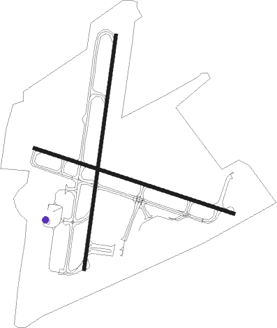
Runway info
Runway 01 / 19  | ||
| length | 3207m (10522ft) | |
| bearing | 15° / 195° | |
| width | 45m (148ft) | |
| surface | asphalt | |
| blast zone | 60m (197ft) / 60m (197ft) | |
| Runway 11 / 29 | ||
| length | 2850m (9350ft) | |
| bearing | 108° / 288° | |
| width | 45m (148ft) | |
| surface | asphalt | |
| displ threshold | 0m (0ft) / 201m (659ft) | |
| blast zone | 196m (643ft) / 161m (528ft) | |
Nearby beacons
| code | identifier | dist | bearing | frequency |
|---|---|---|---|---|
| TUC | TUNIS VOR/DME | 0.2 | 117° | 116.50 |
| TS | RAOUAD NDB | 5.3 | 15° | 325 |
| BIZ | BIZERTE VOR/DME | 31.9 | 310° | 114.20 |
| BN | SIDI BEL ABIOD NDB | 41.2 | 75° | 313 |
| CBN | CAP BON VOR | 41.4 | 87° | 112.70 |
| NBA | ENFIDHA VOR/DME | 47.8 | 165° | 114.35 |
Departure and arrival routes
| Transition altitude | 6000ft |
| SID end points | distance | outbound heading | |
|---|---|---|---|
| RW01 | |||
| ICAN2A | 30mi | 47° | |
| CBN3A | 41mi | 87° | |
| DIDO2A | 40mi | 100° | |
| GIBL2A | 30mi | 154° | |
| NEBR2A | 30mi | 187° | |
| RATB2A | 37mi | 207° | |
| BELE2A | 36mi | 236° | |
| TISR2A | 42mi | 257° | |
| KEMI2A | 39mi | 269° | |
| TOBI2A | 34mi | 343° | |
| RW11 | |||
| ICAN3C | 30mi | 47° | |
| CBN2C | 41mi | 87° | |
| DIDO2C | 40mi | 100° | |
| GIBL2C | 30mi | 154° | |
| NEBR2C | 30mi | 187° | |
| RATB2C | 37mi | 207° | |
| BELE4C | 36mi | 236° | |
| TISR3C | 42mi | 257° | |
| KEMI3C | 39mi | 269° | |
| TOBI3C | 34mi | 343° | |
| RW19 | |||
| ICAN4B | 30mi | 47° | |
| CBN3B | 41mi | 87° | |
| DIDO3B | 40mi | 100° | |
| GIBL3B | 30mi | 154° | |
| NEBR2B | 30mi | 187° | |
| RATB2B | 37mi | 207° | |
| BELE4B | 36mi | 236° | |
| TISR4B | 42mi | 257° | |
| KEMI4B | 39mi | 269° | |
| TOBI4B | 34mi | 343° | |
| RW29 | |||
| ICAN2D | 30mi | 47° | |
| CBN2D | 41mi | 87° | |
| DIDO3D | 40mi | 100° | |
| GIBL3D | 30mi | 154° | |
| NEBR3D | 30mi | 187° | |
| RATB2D | 37mi | 207° | |
| BELE2D | 36mi | 236° | |
| TISR1D | 42mi | 257° | |
| KEMI1D | 39mi | 269° | |
| TOBI2D | 34mi | 343° | |
Disclaimer
The information on this website is not for real aviation. Use this data with the X-Plane flight simulator only! Data taken with kind consent from X-Plane 12 source code and data files. Content is subject to change without notice.