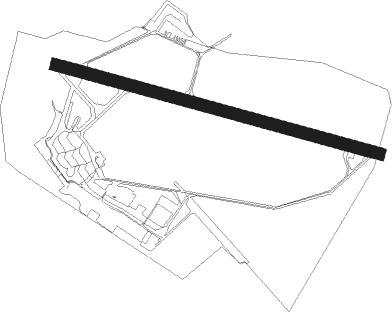
Antwerp - Antwerp Deurne
Airport details
| Country | Belgium |
| State | Antwerp |
| Region | EB |
| Airspace | Brussels Ctr |
| Elevation | 39ft (12m) |
| Timezone | GMT +1 |
| Coordinates | 51.18723, 4.45977 |
| Magnetic var | |
| Type | land |
| Available since | X-Plane v10.32 |
| ICAO code | EBAW |
| IATA code | ANR |
| FAA code | n/a |
Communication
| Antwerp Deurne ANTWERP Ground Control | 121.800 |
| Antwerp Deurne ANTWERP Tower | 135.200 |
| Antwerp Deurne BRUSSELS Approach | 118.250 |
Approach frequencies
| ILS-cat-I | RW29 | 111.75 | 18.00mi |
| 3° GS | RW29 | 111.75 | 18.00mi |
Nearby Points of Interest:
Kasteel Boekenberg
-Blessed Sacrament Church
-Renaat Braem Huis
-Huis Quinten Matsys
-Ensemble De Morgend, Den Dag, Den Tijd, De Nacht en Den Avond
-House De Morgenster
-Ensemble Baeckelmans
-House De Roos
-Huis Les Mouettes
-Iris de Lischbloem
-Woning Napoleon
-Ensemble De Mot
-Ensemble De Pauw
-Notus, Zephyr, Eurus and Boreas
-Meisjeshuis (Antwerp)
-Reuzenhuis
-Huis Hellemans
-Eeuwfeestkliniek
-Hof Ternessen
-Century Center
-Oud gerechtsgebouw Antwerpen
-Schijn
-Les Peupliers
-Den Bell
-Watertoren in Antwerpen, Halenstraat
Nearby beacons
| code | identifier | dist | bearing | frequency |
|---|---|---|---|---|
| ANT | ANTWERP (DEURNE) VOR/DME | 0.5 | 76° | 113.50 |
| ONW | ANTWERP NDB | 4.1 | 101° | 355 |
| NIK | NICKY VOR/DME | 10.4 | 265° | 117.40 |
| BUN | BRUNO VOR/DME | 14.9 | 100° | 110.60 |
| OP | BRUSSELS NATIONAL NDB | 15.7 | 152° | 402 |
| WDT | WOENSDRECHT TACAN | 16.2 | 336° | 115 |
| OB | BRUSSELS NDB | 17 | 150° | 293 |
| BUB | BRUSSELS VOR/DME | 17.3 | 165° | 114.60 |
| AFI | AFFLIGEM VOR/DME | 20.7 | 229° | 114.90 |
| OZ | BRUSSELS NATIONAL NDB | 21.6 | 179° | 314 |
| HUL | HULDENBERG VOR/DME | 27.1 | 157° | 117.55 |
| BBE | BEAUVECHAIN TACAN | 28.3 | 144° | 116 |
| HTB | BEAUVECHAIN NDB | 28.4 | 145° | 381 |
| GZR | GILZE-RIJEN TACAN | 28.8 | 51° | 116.40 |
| FLO | FLORA VOR/DME | 31.5 | 115° | 112.05 |
| EHV | EINDHOVEN TACAN | 37.7 | 74° | 117.20 |
| MAK | MACKEL NDB | 38.7 | 257° | 360 |
| ONC | CHARLEROI NDB | 42 | 172° | 323 |
| CIV | CHIEVRES VORTAC | 43.8 | 226° | 113.20 |
| GSY | GOSLY (CHARLEROI) VOR/DME | 44 | 181° | 115.70 |
| RTM | ROTTERDAM VOR/DME | 47.2 | 2° | 110.40 |
| FRT | DME | 50.4 | 21° | 117.15 |
| BFS | FLORENNES TACAN | 57.2 | 168° | 111.50 |
Departure and arrival routes
| Transition altitude | 4500ft |
| SID end points | distance | outbound heading | |
|---|---|---|---|
| RW11 | |||
| SOND5E | 14mi | 90° | |
| GILO3E, GILO3F, GILO3G | 29mi | 144° | |
| NIK4E | 10mi | 265° | |
| PUTY6E, PUTY2G | 12mi | 326° | |
| RW29 | |||
| SOND6C | 14mi | 90° | |
| GILO3C, GILO4B, GILO4D | 29mi | 144° | |
| NIK5C | 10mi | 265° | |
| PUTY2B, PUTY6C | 12mi | 326° | |
| STAR starting points | distance | inbound heading | |
|---|---|---|---|
| ALL | |||
| ARVO3A | 53.0 | 56° | |
| TULN4A | 58.4 | 62° | |
| KOK4A | 68.1 | 87° | |
| WODY3A | 13.5 | 157° | |
| BATY4A | 61.7 | 291° | |
| LNO4A | 59.5 | 296° | |
Instrument approach procedures
| runway | airway (heading) | route (dist, bearing) |
|---|---|---|
| RW11 | ANT (256°) | ANT 3000ft NIK (11mi, 265°) 3000ft ARPUR (4mi, 285°) BEVRI (5mi, 53°) 3000ft |
| RNAV | BEVRI 3000ft AW11F (4mi, 103°) 3000ft EBAW (8mi, 104°) 78ft AW011 (4mi, 101°) ANT (4mi, 284°) 2000ft |
Holding patterns
| STAR name | hold at | type | turn | heading* | altitude | leg | speed limit |
|---|---|---|---|---|---|---|---|
| ARVO3A | ANT | NDB | left | 297 (117)° | 8000ft - 14000ft | 1.0min timed | ICAO rules |
| BATY4A | ANT | NDB | left | 297 (117)° | 8000ft - 14000ft | 1.0min timed | ICAO rules |
| KOK4A | ANT | NDB | left | 297 (117)° | 8000ft - 14000ft | 1.0min timed | ICAO rules |
| LNO4A | ANT | NDB | left | 297 (117)° | 8000ft - 14000ft | 1.0min timed | ICAO rules |
| TULN4A | ANT | NDB | left | 297 (117)° | 8000ft - 14000ft | 1.0min timed | ICAO rules |
| WODY3A | ANT | NDB | left | 297 (117)° | 8000ft - 14000ft | 1.0min timed | ICAO rules |
| *) magnetic outbound (inbound) holding course | |||||||
Disclaimer
The information on this website is not for real aviation. Use this data with the X-Plane flight simulator only! Data taken with kind consent from X-Plane 12 source code and data files. Content is subject to change without notice.
