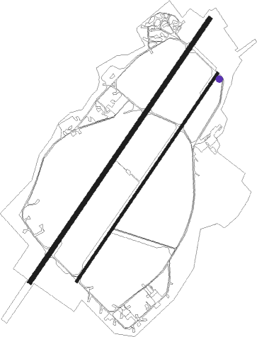
Beauvechain
Airport details
| Country | Belgium |
| State | Walloon Brabant |
| Region | EB |
| Airspace | Brussels Ctr |
| Municipality | Beauvechain |
| Elevation | 338ft (103m) |
| Timezone | GMT +1 |
| Coordinates | 50.74927, 4.77098 |
| Magnetic var | |
| Type | land |
| Available since | X-Plane v10.40 |
| ICAO code | EBBE |
| IATA code | n/a |
| FAA code | n/a |
Communication
| Beauvechain Ground Control | 130.375 |
| Beauvechain Tower | 122.100 |
| Beauvechain Tower | 130.725 |
| Beauvechain Approach | 122.825 |
| Beauvechain GCA | 123.300 |
| Beauvechain Approach | 122.500 |
Approach frequencies
| ILS-cat-I | RW22R | 111.35 | 18.00mi |
| 2.7° GS | RW22R | 111.35 | 18.00mi |
Nearby Points of Interest:
Wahenges Farm
-Former town hall of Jodoigne
-Chapelle Notre-Dame du Bon-Secours de Zétrud-Lumay
-Roman villa (Wavre)
-beguinage of Tienen
-Sint-Rochuskapel (Huldenberg)
-Central prison of Leuven
-Castle Huldenberg
-Saint John the Baptist Church
-Kapel van Onze-Lieve-Vrouw ten Steen
-Royal College Leuven
-Caves of Folx-les-Caves
-Saint Anthony's chapel
-University Hall
-Leuven Town Hall
-Drapers Guild House of Leuven
-Vesalius Instituut
-Sint-Maartensdal
-Augustinian monastery (Leuven)
-Vlierbeek Abbey
-Openbaar Entrepot voor de Kunsten
-Kasteel van IJse
-Ferme de Beaurieux
-Hall n° 11 de l'usine Henricot n°1
-Foyer populaire de Court-Saint-Étienne
Nearby beacons
| code | identifier | dist | bearing | frequency |
|---|---|---|---|---|
| HTB | BEAUVECHAIN NDB | 0.3 | 328° | 381 |
| BBE | BEAUVECHAIN TACAN | 0.4 | 344° | 116 |
| HUL | HULDENBERG VOR/DME | 4.9 | 270° | 117.55 |
| OB | BRUSSELS NDB | 11.8 | 318° | 293 |
| OZ | BRUSSELS NATIONAL NDB | 12.4 | 284° | 314 |
| BUB | BRUSSELS VOR/DME | 12.7 | 303° | 114.60 |
| OP | BRUSSELS NATIONAL NDB | 13.2 | 317° | 402 |
| FLO | FLORA VOR/DME | 15.7 | 71° | 112.05 |
| ONC | CHARLEROI NDB | 17.6 | 220° | 323 |
| GSY | GOSLY (CHARLEROI) VOR/DME | 21.7 | 228° | 115.70 |
| BUN | BRUNO VOR/DME | 22.3 | 11° | 110.60 |
| AFI | AFFLIGEM VOR/DME | 25.7 | 284° | 114.90 |
| ONW | ANTWERP NDB | 26.2 | 334° | 355 |
| LGE | LIEGE VOR/DME | 27.2 | 98° | 115.45 |
| ANT | ANTWERP (DEURNE) VOR/DME | 28.8 | 326° | 113.50 |
| ONL | LIEGE NDB | 29.7 | 94° | 290 |
| BFS | FLORENNES TACAN | 30.8 | 193° | 111.50 |
| NIK | NICKY VOR/DME | 33.4 | 305° | 117.40 |
| SPI | SPRIMONT VOR/DME | 35.4 | 105° | 113.10 |
| BBL | KLEINE BROGEL TACAN | 36.3 | 59° | 109.60 |
| LNO | OLNO VOR/DME | 37 | 100° | 112.80 |
| CIV | CHIEVRES VORTAC | 37.2 | 259° | 113.20 |
| WDT | WOENSDRECHT TACAN | 44.9 | 329° | 115 |
| EHV | EINDHOVEN TACAN | 47.7 | 41° | 117.20 |
| GZR | GILZE-RIJEN TACAN | 49.4 | 11° | 116.40 |
| VKL | VOLKEL TACAN | 64.8 | 46° | 108.30 |
Departure and arrival routes
| Transition altitude | 4500ft |
| SID end points | distance | outbound heading | |
|---|---|---|---|
| RW04L | |||
| BE04A | 36mi | 59° | |
| BE04B | 39mi | 67° | |
| BE04D | 17mi | 130° | |
| BE04E | 18mi | 193° | |
| RW22R | |||
| BE22A | 36mi | 59° | |
| BE22B | 39mi | 67° | |
| BE22D | 17mi | 130° | |
| BE22E | 18mi | 193° | |
Instrument approach procedures
| runway | airway (heading) | route (dist, bearing) |
|---|---|---|
| RW04L | BE500 (294°) | BE500 BE501 (7mi, 232°) 3000ft BE502 (5mi, 297°) 2100ft |
| RNAV | BE502 2100ft BE503 (3mi, 52°) 1300ft BE504 (3mi, 52°) 399ft BE505 (3mi, 52°) 1000ft BE403 (3mi, 52°) 1520ft BE400 (5mi, 117°) 2310ft BE500 (6mi, 232°) 3000ft | |
| RW04R | BE500 (294°) | BE500 BE501 (7mi, 232°) 3000ft BE506 (5mi, 297°) 2100ft |
| RNAV | BE506 2100ft BE507 (3mi, 52°) 1300ft BE508 (3mi, 52°) 400ft BE509 (3mi, 52°) 1000ft BE510 (3mi, 52°) 1490ft BE400 (5mi, 117°) 2110ft BE500 (6mi, 232°) 2880ft | |
| RW22L | BE400 (262°) | BE400 BE401 (5mi, 52°) BE407 (5mi, 297°) 2500ft |
| RNAV | BE407 2500ft BE408 (6mi, 232°) 1800ft BE409 (4mi, 232°) 367ft BE412 (3mi, 232°) 1000ft BE410 (2mi, 232°) 1310ft BE406 (5mi, 117°) 2040ft BE400 (10mi, 53°) 3000ft | |
| RW22R | BE400 (262°) | BE400 BE401 (5mi, 52°) BE402 (5mi, 297°) 2500ft |
| RNAV | BE402 2500ft BE403 (5mi, 232°) 1800ft BE404 (5mi, 232°) 365ft BE411 (3mi, 232°) 1000ft BE405 (2mi, 232°) 1370ft BE406 (5mi, 117°) 1710ft BE400 (10mi, 53°) 3000ft |
Disclaimer
The information on this website is not for real aviation. Use this data with the X-Plane flight simulator only! Data taken with kind consent from X-Plane 12 source code and data files. Content is subject to change without notice.

