Brasschaat - Brasschaat Airfield
Airport details
| Country | Belgium |
| State | Antwerp |
| Region | EB |
| Airspace | Brussels Ctr |
| Municipality | Brasschaat |
| Elevation | 76ft (23m) |
| Timezone | GMT +1 |
| Coordinates | 51.33815, 4.50468 |
| Magnetic var | |
| Type | land |
| Available since | X-Plane v11.50 |
| ICAO code | EBBT |
| IATA code | n/a |
| FAA code | n/a |
Communication
| Brasschaat airfield Brasschaat Radio | 122.905 |
Nearby Points of Interest:
Kamp van Brasschaat
-Kasteel Mishaegen
-Onze-Lieve-Vrouwekerk
-Katerheide mill
-Openbare bibliotheek Schoten
-Sint-Jozefskerk
-Schoolgebouw Quebecstraat
-Districtshuis Merksem
-Oosterweelbrug
-Straatsburgdok
-Bevrijdingsdok
-Heilige-Familiekerk
-Siberiabrug
-Asiabrug
-Amerikadok
-Asiadok
-Schijn
-Watertoren in Antwerpen, Halenstraat
-Frans Tijsmanstunnel
-Noorderpershuis
-Kattendijkdok
-Willembrug
-Hof Ternessen
-Klooster van de Apostelinnen te Antwerpen
-Hervormde kerk
Runway info
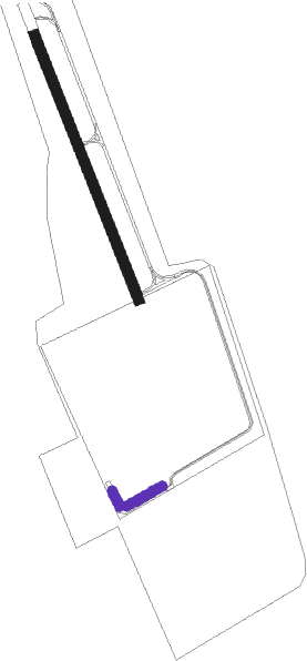
| Runway 16 / 34 | ||
| length | 800m (2625ft) | |
| bearing | 154° / 334° | |
| width | 30m (98ft) | |
| surface | asphalt | |
Nearby beacons
| code | identifier | dist | bearing | frequency |
|---|---|---|---|---|
| ANT | ANTWERP (DEURNE) VOR/DME | 8.9 | 192° | 113.50 |
| WDT | WOENSDRECHT TACAN | 8.9 | 304° | 115 |
| ONW | ANTWERP NDB | 10.5 | 160° | 355 |
| NIK | NICKY VOR/DME | 15.9 | 242° | 117.40 |
| BUN | BRUNO VOR/DME | 18.3 | 123° | 110.60 |
| GZR | GILZE-RIJEN TACAN | 21 | 62° | 116.40 |
| OP | BRUSSELS NATIONAL NDB | 24.2 | 168° | 402 |
| OB | BRUSSELS NDB | 25.4 | 165° | 293 |
| BUB | BRUSSELS VOR/DME | 26.2 | 176° | 114.60 |
| AFI | AFFLIGEM VOR/DME | 29.2 | 220° | 114.90 |
| OZ | BRUSSELS NATIONAL NDB | 30.7 | 184° | 314 |
| EHV | EINDHOVEN TACAN | 33.2 | 83° | 117.20 |
| HUL | HULDENBERG VOR/DME | 35.7 | 167° | 117.55 |
| BBE | BEAUVECHAIN TACAN | 36.3 | 156° | 116 |
| HTB | BEAUVECHAIN NDB | 36.3 | 156° | 381 |
| FLO | FLORA VOR/DME | 36.4 | 126° | 112.05 |
| BBL | KLEINE BROGEL TACAN | 37.4 | 100° | 109.60 |
| RTM | ROTTERDAM VOR/DME | 38.1 | 358° | 110.40 |
| FRT | DME | 41.2 | 22° | 117.15 |
| ONC | CHARLEROI NDB | 51 | 177° | 323 |
| CIV | CHIEVRES VORTAC | 52.4 | 221° | 113.20 |
| GSY | GOSLY (CHARLEROI) VOR/DME | 53.1 | 184° | 115.70 |
| LGE | LIEGE VOR/DME | 54.9 | 125° | 115.45 |
| AMS | DME | 60.1 | 11° | 113.95 |
| SPL | SCHIPHOL (AMSTERDAM) VOR/DME | 60.3 | 14° | 108.40 |
| PAM | PAMPUS VOR/DME | 63.6 | 31° | 117.80 |
Disclaimer
The information on this website is not for real aviation. Use this data with the X-Plane flight simulator only! Data taken with kind consent from X-Plane 12 source code and data files. Content is subject to change without notice.