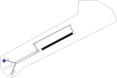
Ursel
Airport details
| Country | Belgium |
| State | East Flanders |
| Region | EB |
| Airspace | Brussels Ctr |
| Municipality | Aalter |
| Elevation | 95ft (29m) |
| Timezone | GMT +1 |
| Coordinates | 51.14417, 3.47556 |
| Magnetic var | |
| Type | land |
| Available since | X-Plane v10.40 |
| ICAO code | EBUL |
| IATA code | n/a |
| FAA code | n/a |
Communication
| Ursel Ursel Radio | 135.125 |
Nearby Points of Interest:
Monastery and school
-Oud schepenhuis
-Sint-Joriskerk
-Belfry of Eeklo
-Kasteel Reesinghe
-Kasteel van Hansbeke
-station Donk
-Duiventoren
-station Sijsele
-Hof ter Cruysse
-Male Castle
-Abdij van Oosteeklo te Gent
-Van Wassenhove House
-Sint-Jozef en Sint-Christoffelkerk
-Kasteel Nieuwenhove
-Goed ten Broeke
-Sint-Theresia van het kind Jezuskerk
-Coupure
-Damme town hall
-Godshuis van de Kleermakers
-Sint-Godelievekerk
-Melkerij Sint Macharius - Wontergem
-Godshuis Bakkersrente
-Godshuis Hertsberge
-Bogardenschool
Nearby beacons
| code | identifier | dist | bearing | frequency |
|---|---|---|---|---|
| MAK | MACKEL NDB | 10.8 | 173° | 360 |
| COA | COSTA VOR/DME | 13 | 329° | 110.05 |
| ONO | OOSTENDE NDB | 18 | 279° | 399 |
| OO | OOSTENDE (OOSTENDE-BRUGGE) NDB | 21.7 | 276° | 375 |
| DD | OOSTENDE (OOSTENDE-BRUGGE) NDB | 24.3 | 274° | 352 |
| NIK | NICKY VOR/DME | 26.7 | 88° | 117.40 |
| AFI | AFFLIGEM VOR/DME | 28.8 | 110° | 114.90 |
| KOK | KOKSY VORTAC | 31.2 | 267° | 114.50 |
| LL | LILLE NDB | 35.2 | 205° | 332 |
| CIV | CHIEVRES VORTAC | 36.8 | 148° | 113.20 |
| WDT | WOENSDRECHT TACAN | 37.3 | 71° | 115 |
| ANT | ANTWERP (DEURNE) VOR/DME | 37.6 | 87° | 113.50 |
| LEQ | LILLE LESQUIN VOR/DME | 37.9 | 214° | 109 |
| MRV | MERVILLE NDB | 40.6 | 238° | 404 |
| OZ | BRUSSELS NATIONAL NDB | 42 | 108° | 314 |
| VS | VALENCIENNES NDB | 47.7 | 189° | 317 |
| MVC | MERVILLE NDB | 48.1 | 237° | 327 |
| GSY | GOSLY (CHARLEROI) VOR/DME | 55.3 | 126° | 115.70 |
| CMB | CAMBRAI EPINOY VOR/DME | 56.3 | 199° | 112.60 |
Disclaimer
The information on this website is not for real aviation. Use this data with the X-Plane flight simulator only! Data taken with kind consent from X-Plane 12 source code and data files. Content is subject to change without notice.
