Airports for X-Plane offers a convenient way to explore airports and their related communication information for the X-Plane flight simulator. It only uses data from the X-Plane flight simulator itself, and is therefore more reliable than the data that comes from real aviation websites. You can search for airports by using the ICAO code, or browse for airports per country and state. The information displayed is categorized by airport details, runway information, airport communication, approach frequencies (ILS and Glidepath details), details of nearby beacons, SIDs, STARs and approach procedures.

near ferry government passenger landing area airliner metro runway southwest city buildings helipad customs traffic propeller plane port international airports airbase field

Kyritz

Airport details

CountryGermany
StateBrandenburg
RegionED
AirspaceBremen Ctr
MunicipalityKyritz
Elevation127ft (39m)
TimezoneGMT +1
Coordinates52.91883, 12.42533
Magnetic var
Typeland
Available sinceX-Plane v10.40
ICAO codeEDBK
IATA coden/a
FAA coden/a

Communication

Kyritz Kyritz Info122.725
Nearby Points of Interest:
St. Peter and Paul Wusterhausen
-
Village church Holzhausen (Kyritz)
-
Zernitz station
-
Dorfkirche Stüdenitz
-
Dorfkirche Sieversdorf (Sieversdorf-Hohenofen)
-
Village church Demerthin
-
Village church Wutike
-
Village church Kantow
-
Village church Gumtow
-
Dorfkirche Brüsenhagen
-
Village church Kerzlin
-
Burgwall Wildberg (Temnitztal)
-
Dorfkirche Gottberg
-
Village church Rossow
-
Village church Dabergotz
-
Dorfkirche Kleßen
-
Village church Dossow
-
Ruppiner Kliniken
-
Dorfkirche Spaatz
-
Village church in Nitzow
-
Stadtkirche St. Laurentius (Havelberg)
-
Steinstraße 4
-
Village church Brunne
-
Gut Buskow
-
Village church Langen (Fehrbellin)

Runway info

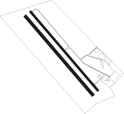
Runway 14 / 32  
 length1001m (3284ft)
 bearing130° / 310°
 width23m (75ft)
 surfaceasphalt
Runway 14R / 32L  
 length998m (3274ft)
 bearing130° / 310°
 width30m (98ft)
 surfacegrass

Nearby beacons

codeidentifierdistbearingfrequency
LWBLOEWENBERG VOR/DME25.691°114.55
BKDBRUENKENDORF VOR/DME32.5277°117.70
PISCHWERIN-PARCHIM NDB37.5316°333
PMDDME38.1308°117.50
PAHSCHWERIN-PARCHIM NDB39.5302°315
MAGMAGDEBURG VOR/DME60214°110.45

Disclaimer

The information on this website is not for real aviation. Use this data with the X-Plane flight simulator only! Data taken with kind consent from X-Plane 12 source code and data files. Content is subject to change without notice.