Kyritz
Airport details
| Country | Germany |
| State | Brandenburg |
| Region | ED |
| Airspace | Bremen Ctr |
| Municipality | Kyritz |
| Elevation | 127ft (39m) |
| Timezone | GMT +1 |
| Coordinates | 52.91883, 12.42533 |
| Magnetic var | |
| Type | land |
| Available since | X-Plane v10.40 |
| ICAO code | EDBK |
| IATA code | n/a |
| FAA code | n/a |
Communication
| Kyritz Kyritz Info | 122.725 |
Nearby Points of Interest:
St. Peter and Paul Wusterhausen
-Village church Holzhausen (Kyritz)
-Zernitz station
-Dorfkirche Stüdenitz
-Dorfkirche Sieversdorf (Sieversdorf-Hohenofen)
-Village church Demerthin
-Village church Wutike
-Village church Kantow
-Village church Gumtow
-Dorfkirche Brüsenhagen
-Village church Kerzlin
-Burgwall Wildberg (Temnitztal)
-Dorfkirche Gottberg
-Village church Rossow
-Village church Dabergotz
-Dorfkirche Kleßen
-Village church Dossow
-Ruppiner Kliniken
-Dorfkirche Spaatz
-Village church in Nitzow
-Stadtkirche St. Laurentius (Havelberg)
-Steinstraße 4
-Village church Brunne
-Gut Buskow
-Village church Langen (Fehrbellin)
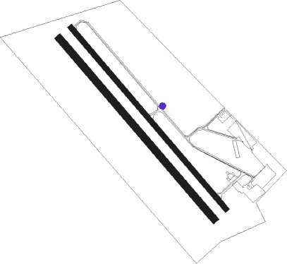
Runway info
Runway 14 / 32  | ||
| length | 1001m (3284ft) | |
| bearing | 130° / 310° | |
| width | 23m (75ft) | |
| surface | asphalt | |
| Runway 14R / 32L | ||
| length | 998m (3274ft) | |
| bearing | 130° / 310° | |
| width | 30m (98ft) | |
| surface | grass | |
Nearby beacons
| code | identifier | dist | bearing | frequency |
|---|---|---|---|---|
| LWB | LOEWENBERG VOR/DME | 25.6 | 91° | 114.55 |
| BKD | BRUENKENDORF VOR/DME | 32.5 | 277° | 117.70 |
| PI | SCHWERIN-PARCHIM NDB | 37.5 | 316° | 333 |
| PMD | DME | 38.1 | 308° | 117.50 |
| PAH | SCHWERIN-PARCHIM NDB | 39.5 | 302° | 315 |
| MAG | MAGDEBURG VOR/DME | 60 | 214° | 110.45 |
Disclaimer
The information on this website is not for real aviation. Use this data with the X-Plane flight simulator only! Data taken with kind consent from X-Plane 12 source code and data files. Content is subject to change without notice.