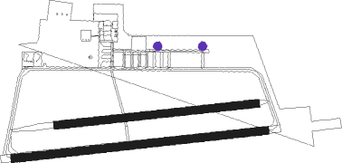
Magdeburg - Magdeburg City
Airport details
| Country | Germany |
| State | Saxony-Anhalt |
| Region | ED |
| Airspace | Bremen Ctr |
| Municipality | Magdeburg |
| Elevation | 268ft (82m) |
| Timezone | GMT +1 |
| Coordinates | 52.07688, 11.62397 |
| Magnetic var | |
| Type | land |
| Available since | X-Plane v10.40 |
| ICAO code | EDBM |
| IATA code | ZMG |
| FAA code | n/a |
Communication
| Magdeburg City Magdeburg Info | 119.300 |
Nearby beacons
| code | identifier | dist | bearing | frequency |
|---|---|---|---|---|
| MAG | MAGDEBURG VOR/DME | 7.9 | 116° | 110.45 |
| CB | COCHSTEDT NDB | 14.4 | 219° | 344 |
| HLZ | HEHLINGEN VOR/DME | 35 | 289° | 117.30 |
| GOT | GOTEM VOR/DME | 44 | 182° | 115.25 |
| LND | NORTH(LEIPZIG- DME | 44.6 | 137° | 113.50 |
| LLD | SOUTH(LEIPZIG- DME | 45.6 | 138° | 112.15 |
| ZIG | LEIPZIG NDB | 45.6 | 134° | 340 |
| SKZ | SCHKEUDITZ (LEIPZIG-HALLE) NDB | 46.4 | 136° | 357 |
| LEG | LEIPZIG VOR/DME | 49.7 | 127° | 115.85 |
| BKD | BRUENKENDORF VOR/DME | 57.5 | 355° | 117.70 |
Departure and arrival routes
| Transition altitude | 5000ft |
| SID end points | distance | outbound heading | |
|---|---|---|---|
| RW09 | |||
| BURE1G | 18mi | 41° | |
| BURO1G | 29mi | 89° | |
| POVE1G | 30mi | 274° | |
| RW27 | |||
| BURE1P | 18mi | 41° | |
| BURO1P | 29mi | 89° | |
| POVE1P | 30mi | 274° | |
Instrument approach procedures
| runway | airway (heading) | route (dist, bearing) |
|---|---|---|
| RW27 | BUREL (221°) | BUREL BM431 (7mi, 171°) 4500ft BM432 (4mi, 171°) 3500ft BM433 (3mi, 177°) 3000ft BM452 (3mi, 177°) 2000ft |
| RW27 | MAG (296°) | MAG 4000ft BM442 (4mi, 90°) 3000ft BM443 (3mi, 357°) 3000ft BM452 (3mi, 357°) 2000ft |
| RNAV | BM452 2000ft GIRDU (4mi, 269°) 2000ft EDBM (6mi, 270°) 299ft BM013 (6mi, 268°) (3180mi, 192°) 2000ft BM014 (3178mi, 12°) MAG (12mi, 95°) 4000ft |
Disclaimer
The information on this website is not for real aviation. Use this data with the X-Plane flight simulator only! Data taken with kind consent from X-Plane 12 source code and data files. Content is subject to change without notice.

