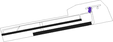
Zellendorf - Oehna
Airport details
| Country | Germany |
| State | Brandenburg |
| Region | ED |
| Airspace | Bremen Ctr |
| Municipality | Niedergörsdorf |
| Elevation | 287ft (87m) |
| Timezone | GMT +1 |
| Coordinates | 51.89900, 13.05583 |
| Magnetic var | |
| Type | land |
| Available since | X-Plane v10.40 |
| ICAO code | EDBO |
| IATA code | n/a |
| FAA code | n/a |
Communication
| Oehna Oehna Info | 122.500 |
Nearby beacons
| code | identifier | dist | bearing | frequency |
|---|---|---|---|---|
| HOZ | HOLZDORF NDB | 7.8 | 162° | 406 |
| HOZ | HOLZDORF TACAN | 9.5 | 133° | 117.25 |
| KLF | KLASDORF VOR/DME | 20.1 | 77° | 115.15 |
| BBI | BERLIN BRANDENBURG VOR/DME | 30.3 | 42° | 114.10 |
| SDD | DME | 32.9 | 43° | 114.40 |
| LEG | LEIPZIG VOR/DME | 35.2 | 232° | 115.85 |
| ZIG | LEIPZIG NDB | 40.1 | 239° | 340 |
| SKZ | SCHKEUDITZ (LEIPZIG-HALLE) NDB | 41.2 | 238° | 357 |
| LND | NORTH(LEIPZIG- DME | 41.6 | 241° | 113.50 |
| LLD | SOUTH(LEIPZIG- DME | 42.3 | 240° | 112.15 |
| FS | DRESDEN NDB | 51.7 | 132° | 374 |
| DND | DME | 53.1 | 138° | 115.40 |
| DRN | DRESDEN VOR/DME | 56.8 | 148° | 114.35 |
| ABU | ALTENBURG NDB | 57.9 | 211° | 330 |
| AGD | DME | 58.6 | 211° | 115.30 |
Disclaimer
The information on this website is not for real aviation. Use this data with the X-Plane flight simulator only! Data taken with kind consent from X-Plane 12 source code and data files. Content is subject to change without notice.

