Allstedt
Airport details
| Country | Germany |
| State | Saxony-Anhalt |
| Region | ED |
| Airspace | Munich Ctr |
| Municipality | Allstedt |
| Elevation | 931ft (284m) |
| Timezone | GMT +1 |
| Coordinates | 51.38050, 11.44667 |
| Magnetic var | |
| Type | land |
| Available since | X-Plane v10.30 |
| ICAO code | EDBT |
| IATA code | n/a |
| FAA code | n/a |
Communication
| Allstedt Allstedt Info | 122.000 |
Nearby Points of Interest:
St. Petri (Landgrafroda)
-Burg und Schloss Allstedt
-Rathaus Allstedt
-Schloss Lodersleben
-Denkmal Kaiser Wilhelm I.
-Kirche Heygendorf
-Kriegerdenkmal Leimbach
-Kirche Leimbach (Querfurt)
-St. Peter und Paul (Oberschmon)
-St. Petri
-Huthügel
-Friedhof Querfurt
-Sittichenbach Abbey
-St. Salvator (Querfurt)
-Kirche Rothenschirmbach
-Heilig-Geist-Kirche
-Schleuse Artern
-St.-Bartholomäus-Kirche
-Dorfkirche Spielberg
-Meilenstein Emseloh
-Gasthof zum Mohr
-Kriegerdenkmal Barnstädt
-St. Moritz
-Sankt Ulrici (Sangerhausen)
-Preußischer Ganzmeilenobelisk (Wimmelburg)
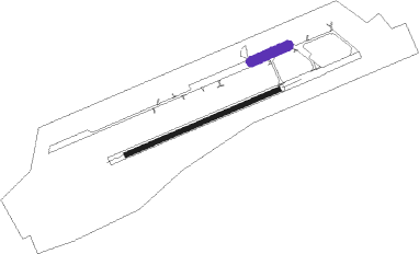
Runway info
| Runway 07 / 25 | ||
| length | 1190m (3904ft) | |
| bearing | 78° / 258° | |
| width | 30m (98ft) | |
| surface | concrete | |
Nearby beacons
| code | identifier | dist | bearing | frequency |
|---|---|---|---|---|
| GOT | GOTEM VOR/DME | 6 | 104° | 115.25 |
| ERF | ERFURT VOR/DME | 26.9 | 206° | 113.85 |
| CB | COCHSTEDT NDB | 28.8 | 0° | 344 |
| LND | NORTH(LEIPZIG- DME | 29.3 | 86° | 113.50 |
| LLD | SOUTH(LEIPZIG- DME | 29.4 | 87° | 112.15 |
| EFD | DME | 30.1 | 231° | 112.05 |
| SKZ | SCHKEUDITZ (LEIPZIG-HALLE) NDB | 30.9 | 88° | 357 |
| ZIG | LEIPZIG NDB | 31.4 | 86° | 340 |
| MAG | MAGDEBURG VOR/DME | 39.1 | 29° | 110.45 |
| HLZ | HEHLINGEN VOR/DME | 63.7 | 326° | 117.30 |
| BRU | BRAUNSCHWEIG-WOLFSBURG NDB | 64.5 | 318° | 427 |
Disclaimer
The information on this website is not for real aviation. Use this data with the X-Plane flight simulator only! Data taken with kind consent from X-Plane 12 source code and data files. Content is subject to change without notice.