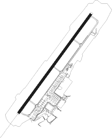
Dresden
Airport details
| Country | Germany |
| State | Saxony |
| Region | ED |
| Airspace | Munich Ctr |
| Municipality | Dresden |
| Elevation | 751ft (229m) |
| Timezone | GMT +1 |
| Coordinates | 51.13284, 13.77194 |
| Magnetic var | |
| Type | land |
| Available since | X-Plane v10.40 |
| ICAO code | EDDC |
| IATA code | DRS |
| FAA code | n/a |
Communication
| Dresden Dresden ATIS | 118.880 |
| Dresden Dresden Apron | 121.755 |
| Dresden Dresden Ground | 121.980 |
| Dresden Dresden Tower | 122.930 |
| Dresden Munich Radar | 125.875 |
Approach frequencies
| ILS-cat-III | RW22 | 109.75 | 18.00mi |
| ILS-cat-I | RW04 | 110.5 | 18.00mi |
| 3° GS | RW04 | 110.5 | 18.00mi |
| 3° GS | RW22 | 109.75 | 18.00mi |
Nearby Points of Interest:
Sächsische Landesschule
-Villa Trinkl
-Mietvilla Wilder-Mann-Straße 45
-Mietvilla Wilder-Mann-Straße 41
-Kurhaus Wettin
-VEB Strömungsmaschinen Dresden
-Villa Wilder-Mann-Straße 29
-Wasserwerk Trachau
-Kursächsischer Grenzstein Oberlößnitz
-Hagensche Villa
-Doppelhaus Wilder-Mann-Straße 19/21
-Villa Lindemann
-Meyer-Villa
-House Wilder-Mann-Straße 5
-Goehle-Werk
-Hertwig-Bünger-Heim
-Villa Carola
-Haus Windisch
-Landhaus Heinrich Mehlig
-Villa Blumberger
-Rundhaus (Radebeul)
-Zweifamilienhaus Karl Hebenstreit
-Villa Heinrich Findeisen
-Fabrikantenvilla Kartonagenfabrik Paul Leinert
-Sachsenbad Dresden
Nearby beacons
| code | identifier | dist | bearing | frequency |
|---|---|---|---|---|
| DND | DME | 0.5 | 257° | 115.40 |
| FS | DRESDEN NDB | 4.6 | 52° | 374 |
| DRN | DRESDEN VOR/DME | 9.6 | 236° | 114.35 |
| HDO | HERMSDORF VOR/DME | 25.6 | 109° | 108.65 |
| HOZ | HOLZDORF TACAN | 43.6 | 318° | 117.25 |
| HOZ | HOLZDORF NDB | 45.8 | 313° | 406 |
| KLF | KLASDORF VOR/DME | 53.8 | 347° | 115.15 |
| NER | NERATOVICE VOR/DME | 56.2 | 132° | 112.25 |
| V | MASLOVICE (VODOCHODY) NDB | 59.4 | 147° | 416 |
| L | VRATA (KARLOVY VARY) NDB | 64.5 | 222° | 365 |
| KD | KBELY NDB | 67.4 | 139° | 300 |
Departure and arrival routes
| Transition altitude | 5000ft |
| SID end points | distance | outbound heading | |
|---|---|---|---|
| RW04 | |||
| KOBU8E | 29mi | 52° | |
| HDO8E | 26mi | 109° | |
| DEKO5E | 22mi | 118° | |
| LALU5E | 20mi | 162° | |
| MARE7E | 26mi | 199° | |
| ABKI3E | 41mi | 235° | |
| BEBE7E | 25mi | 291° | |
| OSKA9E | 20mi | 336° | |
| RW22 | |||
| KOBU1W | 29mi | 52° | |
| HDO1W | 26mi | 109° | |
| DEKO6W | 22mi | 118° | |
| LALU4W | 20mi | 162° | |
| MARE5W | 26mi | 199° | |
| ABKI3W | 41mi | 235° | |
| BEBE7W | 25mi | 291° | |
| OSKA3D, OSKA7W | 20mi | 336° | |
| STAR starting points | distance | inbound heading | |
|---|---|---|---|
| RW04 | |||
| OSKA4B | 20.4 | 156° | |
| RW22 | |||
| OSKA4A | 20.4 | 156° | |
Instrument approach procedures
| runway | airway (heading) | route (dist, bearing) |
|---|---|---|
| RW04 | ABK04 (15°) | ABKIS DC428 (8mi, 19°) DC429 (18mi, 20°) 5000ft RIVSA (6mi, 74°) 5000ft DC422 (4mi, 115°) 5000ft DC420 (8mi, 234°) 5000ft DC430 (6mi, 118°) 4000ft DC431 (2mi, 54°) 4000ft |
| RW04 | DRN (56°) | DRN 5000ft DC491 (3mi, 354°) DC492 (3mi, 299°) 5000ft DC493 (9mi, 234°) 5000ft DC431 (5mi, 118°) 4000ft |
| RW04 | GAR04 (15°) | GARKI DC457 (8mi, 158°) DC453 (19mi, 234°) DC450 (16mi, 234°) 5000ft DC430 (6mi, 299°) 4000ft DC431 (2mi, 54°) 4000ft |
| RW04 | HDO04 (15°) | HDO DC453 (21mi, 280°) DC450 (16mi, 234°) 5000ft DC430 (6mi, 299°) 4000ft DC431 (2mi, 54°) 4000ft |
| RW04 | OSK04 (15°) | OSKAN EPILA (16mi, 179°) DC420 (18mi, 234°) 5000ft DC430 (6mi, 118°) 4000ft DC431 (2mi, 54°) 4000ft |
| RW04 | RIV04 (15°) | RIVSA DC422 (4mi, 115°) DC420 (8mi, 234°) 5000ft DC430 (6mi, 118°) 4000ft DC431 (2mi, 54°) 4000ft |
| RNAV | DC431 4000ft GOMPA (6mi, 54°) 4000ft EDDC (11mi, 55°) 804ft DC480 (5mi, 52°) 1160ft (3154mi, 195°) 2500ft DC494 (3157mi, 15°) DC495 (5mi, 251°) D009J (2mi, 198°) 4000ft DRN (10mi, 199°) 5000ft | |
| RW22 | ABK22 (15°) | ABKIS DC450 (23mi, 69°) DC454 (18mi, 54°) DC457 (16mi, 54°) DC437 (6mi, 299°) 4000ft DC436 (4mi, 234°) 3000ft |
| RW22 | DRN (56°) | DRN 5000ft DC458 (17mi, 69°) 4000ft DC459 (5mi, 54°) 4000ft DC436 (5mi, 299°) 3000ft |
| RW22 | GAR22 (15°) | GARKI DC437 (4mi, 235°) 4000ft DC436 (4mi, 234°) 3000ft |
| RW22 | GARKI (234°) | GARKI 5000ft DC437 (4mi, 235°) 4000ft DC436 (4mi, 234°) 3000ft |
| RW22 | HDO22 (15°) | HDO DC460 (15mi, 280°) DC454 (5mi, 299°) DC457 (16mi, 54°) DC437 (6mi, 299°) 4000ft DC436 (4mi, 234°) 3000ft |
| RW22 | OSK22 (15°) | OSKAN DC410 (14mi, 195°) EPILA (3mi, 118°) DC427 (16mi, 54°) DC437 (6mi, 118°) 4000ft DC436 (4mi, 234°) 3000ft |
| RW22 | RIV22 (15°) | RIVSA EPILA (11mi, 72°) DC427 (16mi, 54°) DC437 (6mi, 118°) 4000ft DC436 (4mi, 234°) 3000ft |
| RNAV | DC436 3000ft OKILO (4mi, 234°) 3000ft EDDC (8mi, 233°) 750ft (3150mi, 195°) 1160ft DRN (3141mi, 15°) 5000ft |
Holding patterns
| STAR name | hold at | type | turn | heading* | altitude | leg | speed limit |
|---|---|---|---|---|---|---|---|
| OSKA4A | GARKI | VHF | left | 38 (218)° | > 5000ft | 1.0min timed | ICAO rules |
| OSKA4B | DRN | NDB | left | 218 (38)° | > 5000ft | 1.0min timed | ICAO rules |
| *) magnetic outbound (inbound) holding course | |||||||
Disclaimer
The information on this website is not for real aviation. Use this data with the X-Plane flight simulator only! Data taken with kind consent from X-Plane 12 source code and data files. Content is subject to change without notice.