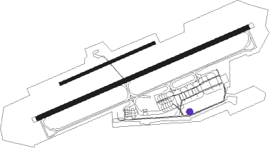
Münster - Muenster- Osnabrueck
Airport details
| Country | Germany |
| State | North Rhine-Westphalia |
| Region | ED |
| Airspace | Langen Ctr |
| Municipality | Greven |
| Elevation | 159ft (48m) |
| Timezone | GMT +1 |
| Coordinates | 52.13464, 7.68483 |
| Magnetic var | |
| Type | land |
| Available since | X-Plane v10.40 |
| ICAO code | EDDG |
| IATA code | FMO |
| FAA code | n/a |
Communication
| Muenster- Osnabrueck Muenster ATIS | 127.180 |
| Muenster- Osnabrueck Muenster Ground Control | 121.880 |
| Muenster- Osnabrueck Muenster Tower | 129.805 |
| Muenster- Osnabrueck Langen RADAR | 129.300 |
Approach frequencies
| ILS-cat-III | RW25 | 110.1 | 18.00mi |
| ILS-cat-I | RW07 | 111.75 | 18.00mi |
| 3° GS | RW07 | 111.75 | 18.00mi |
| 3° GS | RW25 | 110.1 | 18.00mi |
Nearby Points of Interest:
Weidenhof
-Tecklenburg
-Jüdischer Friedhof (Lengerich)
-Brinkjans Krüüs
-Rochuskapelle (Ostbevern)
-Donatusstatue
-Heimathaus
-Kapelle zur schmerzhaften Mutter
-Anna-Kapelle
-Amtsgericht Ibbenbüren
-Haus Bevern
-Schloss Loburg
-Speicherstadt Münster
-Herold House
-Gereonkapelle
-Jüdischer Friedhof (Ibbenbüren)
-Old Saint John the Baptist Church
-Schleuse Bergeshövede
-St. Clemens Telgte
-Wallfahrtskapelle Telgte
-Villa Sunder-Plaßmann
-Kriegsgräberstätte Haus Spital
-Deutsches Studentenheim
-North Rhine-Westphalia State Archives Westphalia Division
-Lotharinger Chorfrauenkirche
Runway info
Runway 07 / 25  | ||
| length | 2162m (7093ft) | |
| bearing | 78° / 258° | |
| width | 45m (148ft) | |
| surface | asphalt | |
| displ threshold | 0m (0ft) / 190m (623ft) | |
| Runway 07L / 25R | ||
| length | 962m (3156ft) | |
| bearing | 78° / 258° | |
| width | 30m (98ft) | |
| surface | grass | |
Nearby beacons
| code | identifier | dist | bearing | frequency |
|---|---|---|---|---|
| MOD | DME | 0.2 | 36° | 114.05 |
| MYN | MUENSTER/OSNABRUECK NDB | 4.4 | 78° | 371 |
| HMM | HAMM VOR/DME | 16.7 | 175° | 115.65 |
| OSB | OSNABRUCK TACAN | 22.4 | 84° | 108.35 |
| OSN | OSNABRUECK VOR | 22.4 | 84° | 114.30 |
| RKN | DME | 33.9 | 270° | 116.80 |
| DWI | DORTMUND-WICKEDE NDB | 36.5 | 185° | 357 |
| DOR | WICKEDE (DORTMUND) VOR/DME | 36.6 | 185° | 108.65 |
| DP | DIEPHOLZ NDB | 39.3 | 59° | 325 |
| BOT | BOTTROP NDB | 41 | 230° | 406 |
| PAD | DME-ILS | 46.8 | 119° | 108.50 |
| BAM | BARMEN VOR/DME | 52 | 212° | 114 |
| LI | DUESSELDORF NDB | 55.7 | 225° | 417 |
| GMH | GERMINGHAUSEN VOR/DME | 58.4 | 168° | 115.40 |
| DUS | DUESSELDORF VOR/DME | 61.7 | 228° | 115.15 |
Departure and arrival routes
| Transition altitude | 5000ft |
| SID end points | distance | outbound heading | |
|---|---|---|---|
| RW07 | |||
| OSN9E | 22mi | 84° | |
| DOME2Y, DOME3E | 26mi | 193° | |
| RKN9Y, RKN2E | 34mi | 270° | |
| RW25 | |||
| OSN2C, OSN9X | 22mi | 84° | |
| DOME2C, DOME2Z | 26mi | 193° | |
| RKN1C | 34mi | 270° | |
| STAR starting points | distance | inbound heading | |
|---|---|---|---|
| ALL | |||
| DOME2J | 25.7 | 13° | |
| BAMS2J | 58.5 | 22° | |
Instrument approach procedures
| runway | airway (heading) | route (dist, bearing) |
|---|---|---|
| RW07 | HMM (355°) | HMM DG011 (14mi, 292°) 5000ft DG012 (5mi, 331°) 3000ft |
| RW07 | OSN (264°) | OSN DG010 (10mi, 252°) 5000ft DG011 (25mi, 258°) 5000ft DG012 (5mi, 331°) 3000ft |
| RNAV | DG012 3000ft KEMOT (4mi, 78°) 3000ft EDDG (9mi, 78°) 206ft (3155mi, 188°) 560ft DG013 (3157mi, 9°) DG040 (3mi, 121°) DG041 (10mi, 210°) 4000ft HMM (7mi, 210°) 5000ft | |
| RW25 | HMM (355°) | HMM DG014 (23mi, 55°) 5000ft DG016 (5mi, 299°) 3000ft |
| RW25 | OSN (264°) | OSN DG015 (5mi, 271°) 5000ft DG016 (5mi, 271°) 3000ft |
| RNAV | DG016 3000ft IBATO (4mi, 258°) 3000ft EDDG (9mi, 258°) 209ft DG017 (5mi, 258°) DG020 (3mi, 212°) HMM (14mi, 139°) 5000ft |
Holding patterns
| STAR name | hold at | type | turn | heading* | altitude | leg | speed limit |
|---|---|---|---|---|---|---|---|
| BAMS2J | HMM | NDB | left | 77 (257)° | 5000ft - 14000ft | 1.0min timed | ICAO rules |
| DOME2J | HMM | NDB | left | 77 (257)° | 5000ft - 14000ft | 1.0min timed | ICAO rules |
| *) magnetic outbound (inbound) holding course | |||||||
Disclaimer
The information on this website is not for real aviation. Use this data with the X-Plane flight simulator only! Data taken with kind consent from X-Plane 12 source code and data files. Content is subject to change without notice.