Saarbrücken - Saarbruecken
Airport details
| Country | Germany |
| State | Saarland |
| Region | ED |
| Airspace | Langen Ctr |
| Municipality | Saarbrücken |
| Elevation | 1057ft (322m) |
| Timezone | GMT +1 |
| Coordinates | 49.21455, 7.10951 |
| Magnetic var | |
| Type | land |
| Available since | X-Plane v10.40 |
| ICAO code | EDDR |
| IATA code | SCN |
| FAA code | n/a |
Communication
| Saarbruecken Saarbruecken ATIS | 125.475 |
| Saarbruecken Saarbruecken Tower | 118.350 |
| Saarbruecken Langen Radar | 129.675 |
Approach frequencies
| ILS-cat-I | RW27 | 111.1 | 18.00mi |
| 3° GS | RW27 | 111.1 | 18.00mi |
Nearby Points of Interest:
St. Peter
-St. Lukas
-Villa Wagner
-Kohlweg 18
-Pfarrgaßschulhaus
-Protestant Church (Hassel, Saar)
-St. Anna
-St. Josef
-Former synagogue (Sankt Ingbert)
-Gustav-Bruch-Straße 24
-Jüdischer Friedhof
-Winterbergdenkmal
-Paul-Marien-Stift
-Garage
-Försterstraße 6/8
-Gasthaus "Zum Stiefel"
-Protestantische Kirche (Wolfersheim)
-Museum am Schlossplatz
-Congresshalle
-St. Maria
-Salzhaus
-Evangelical Church
-Protestantische Kirche
-Synagoge
-Evangelische Kirche
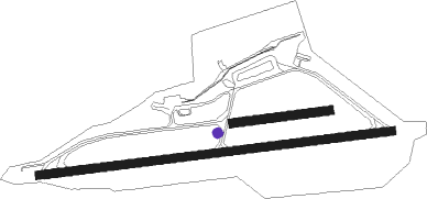
Runway info
Runway 09 / 27  | ||
| length | 1986m (6516ft) | |
| bearing | 88° / 268° | |
| width | 45m (148ft) | |
| surface | asphalt | |
| displ threshold | 55m (180ft) / 104m (341ft) | |
| blast zone | 100m (328ft) / 0m (0ft) | |
| Runway 09L / 27R | ||
| length | 544m (1785ft) | |
| bearing | 88° / 268° | |
| width | 50m (164ft) | |
| surface | grass | |
Nearby beacons
| code | identifier | dist | bearing | frequency |
|---|---|---|---|---|
| SAD | DME | 0.2 | 108° | 116.75 |
| SR | ENSHEIM (SAARBRUECKEN) NDB | 4.3 | 88° | 360 |
| ZWN | ZWEIBRUECKEN VOR/DME | 12.1 | 87° | 114.80 |
| GTQ | GROSTENQUIN VOR/DME | 20.6 | 240° | 111.25 |
| RMS | RAMSTEIN TACAN | 22.8 | 65° | 113.40 |
| PHG | PHALSBOURG NDB | 27.1 | 169° | 424 |
| SAV | SAVERNE VOR/DME | 28.4 | 141° | 110.45 |
| LOU | LORRAINE NDB | 35.4 | 256° | 388 |
| MTZ | METZ NDB | 35.5 | 274° | 354 |
| ELU | LUXEMBOURG NDB | 40.5 | 302° | 368 |
| LE | LUXEMBOURG NDB | 42.2 | 296° | 318 |
| LUX | LUXEMBOURG VOR/DME | 42.2 | 296° | 112.25 |
| LW | LUXEMBOURG NDB | 43.6 | 293° | 404 |
| FHH | DME | 44 | 12° | 117.35 |
| SE | STRASBOURG NDB | 44.5 | 136° | 412 |
| HAN | HAHN NDB | 45.5 | 13° | 376 |
| KBA | KARLSRUHE/BADEN-BADEN NDB | 46.2 | 113° | 431 |
| STR | STRASBOURG ENTZHEIM VOR/DME | 46.3 | 147° | 115.60 |
| KBD | DME | 46.5 | 114° | 115.80 |
| SPA | SPANGDAHLEM TACAN | 48.6 | 332° | 109.50 |
| DIK | DIEKIRCH NDB | 54.4 | 303° | 307 |
| BUE | BUECHEL TACAN | 57.9 | 358° | 117.10 |
| LRD | DME | 58.4 | 140° | 108.05 |
| LHR | LAHR NDB | 58.9 | 141° | 337 |
| EMT | EPINAL NDB | 64.1 | 226° | 419 |
Departure and arrival routes
| Transition altitude | 5000ft |
| Transition level | 60ft |
| SID end points | distance | outbound heading | |
|---|---|---|---|
| RW09 | |||
| ZWN1L, ZWN8E | 12mi | 87° | |
| GTQ1E, GTQ1L | 21mi | 240° | |
| TOMP1K, TOMP1L, TOMP6E | 11mi | 344° | |
| RW27 | |||
| ZWN1M, ZWN5W | 12mi | 87° | |
| GTQ9W, GTQ1M | 21mi | 240° | |
| TOMP1M, TOMP1N, TOMP4W | 11mi | 344° | |
Instrument approach procedures
| runway | airway (heading) | route (dist, bearing) |
|---|---|---|
| RW09 | TOMPI (164°) | TOMPI 6000ft DR402 (6mi, 251°) 6000ft DR401 (5mi, 251°) 4000ft DR400 (5mi, 198°) 3500ft PETID (5mi, 98°) 3500ft |
| RW09 | ZWN (267°) | ZWN 4000ft DR401 (24mi, 277°) DR400 (5mi, 198°) 3500ft PETID (5mi, 98°) 3500ft |
| RNAV | PETID 3500ft EDDR (8mi, 88°) 1074ft ZWN (12mi, 87°) 4000ft | |
| RW27 | ZWN (267°) | ZWN 4000ft OMESA (3mi, 263°) 4000ft |
| RNAV | OMESA 4000ft EDDR (10mi, 268°) 1108ft DR511 (3mi, 268°) (2978mi, 188°) 2500ft DR513 (2983mi, 8°) TOMPI (6mi, 40°) ZWN (17mi, 114°) 4000ft |
Disclaimer
The information on this website is not for real aviation. Use this data with the X-Plane flight simulator only! Data taken with kind consent from X-Plane 12 source code and data files. Content is subject to change without notice.