Berlin - Berlin Tegel
Airport details
| Country | Germany |
| State | Berlin |
| Region | ED |
| Airspace | Bremen Ctr |
| Elevation | 122ft (37m) |
| Timezone | GMT +1 |
| Coordinates | 52.55673, 13.29282 |
| Magnetic var | |
| Type | land |
| Available since | X-Plane v10.40 |
| ICAO code | EDDT |
| IATA code | TXL |
| FAA code | n/a |
Communication
Nearby Points of Interest:
Jungfernheide
-Justizvollzugsanstalt Tegel
-Julius-Leber-Kaserne
-St. Bernhard
-St. Joseph-Kirche
-Friedrich-Ebert-Siedlung
-BVG-Autobus-Betriebshof mit Wohnanlage
-Allerheiligenkirche
-Meilenwerk Berlin
-Westhafen
-Paul-Gerhardt-Stift
-Karl-Bonhoeffer-Nervenklinik
-Virchow Klinikum
-St. Philippus-Apostel-Kirchhof
-Feuerwache Schillerpark
-Borsig-Villa Reiherwerder
-Kiosk Seestraße (Berlin-Wedding)
-Preußisches Institut für Infektionskrankheiten
-Weiße Stadt
-Ledigenheim für Männer
-Rathaus Wedding
-Bauernhof Großkopf
-Karl-Schrader-Haus
-Amtshaus Reinickendorf
-Charlottenburg Town Hall
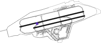
Runway info
Runway 08L / 26R  | ||
| length | 3014m (9888ft) | |
| bearing | 84° / 264° | |
| width | 46m (151ft) | |
| surface | asphalt | |
| blast zone | 66m (217ft) / 70m (230ft) | |
| Runway 08R / 26L | ||
| length | 2409m (7904ft) | |
| bearing | 84° / 264° | |
| width | 46m (151ft) | |
| surface | asphalt | |
| displ threshold | 99m (325ft) / 211m (692ft) | |
| blast zone | 50m (164ft) / 72m (236ft) | |
Nearby beacons
| code | identifier | dist | bearing | frequency |
|---|---|---|---|---|
| SDD | DME | 13.3 | 131° | 114.40 |
| BBI | BERLIN BRANDENBURG VOR/DME | 14.1 | 143° | 114.10 |
| LWB | LOEWENBERG VOR/DME | 21.9 | 336° | 114.55 |
| FWE | FUERSTENWALDE VOR/DME | 31.8 | 100° | 113.30 |
| KLF | KLASDORF VOR/DME | 33.7 | 153° | 115.15 |
| HOZ | HOLZDORF TACAN | 47.5 | 187° | 117.25 |
| HOZ | HOLZDORF NDB | 47.7 | 194° | 406 |
Disclaimer
The information on this website is not for real aviation. Use this data with the X-Plane flight simulator only! Data taken with kind consent from X-Plane 12 source code and data files. Content is subject to change without notice.