Reichelsheim
Airport details
| Country | Germany |
| State | Hesse |
| Region | ED |
| Airspace | Langen Ctr |
| Municipality | Reichelsheim |
| Elevation | 400ft (122m) |
| Timezone | GMT +1 |
| Coordinates | 50.33558, 8.87712 |
| Magnetic var | |
| Type | land |
| Available since | X-Plane v10.40 |
| ICAO code | EDFB |
| IATA code | n/a |
| FAA code | n/a |
Communication
| Reichelsheim Reichelsheim Info | 120.425 |
Nearby Points of Interest:
Burg Staden
-Löw’sches Schloss
-Kleinkastell Lochberg
-Kleinkastell Stammheim
-Kirche Bauernheim
-Assenheim (Niddatal) - Ehem. Synagoge
-Evangelische Kirche Assenheim
-Echzeller Burg
-Dreifaltigskeitskirche
-Schloss Dorheim
-Jüdischer Friedhof Assenheim
-Pfarrkirche Bruchenbrücken
-Evangelische Kirche Bisses
-Kloster Ilbenstadt
-Umspannwerk des ehem. Braunkohlekraftwerkes Wölfersheim
-Schwarzer Turm in Wölfersheim
-Lindheim Castle
-Wasserwerk mit Aussichtsturm
-Evangelische Kirche Geiß-Nidda
-Altes Rathaus Wohnbach
-Evangelische Kapelle
-Löw’sches Schloss Steinfurth
-Bad Salzhausen station
-Kommenturgasse 9 (Obbornhofen)
-Evangelische Kirche Steinheim
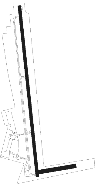
Runway info
Runway 08 / 26  | ||
| length | 269m (883ft) | |
| bearing | 87° / 267° | |
| width | 30m (98ft) | |
| surface | grass | |
| Runway 18 / 36 | ||
| length | 1301m (4268ft) | |
| bearing | 178° / 358° | |
| width | 23m (75ft) | |
| surface | asphalt | |
| displ threshold | 70m (230ft) / 0m (0ft) | |
Nearby beacons
| code | identifier | dist | bearing | frequency |
|---|---|---|---|---|
| MTR | METRO VOR | 3.7 | 206° | 110 |
| GED | GEDERN VORTAC | 14.9 | 78° | 110.80 |
| FR | FRANKFURT NDB | 17.8 | 216° | 297 |
| FFM | FRANKFURT VORTAC | 19.2 | 220° | 114.20 |
| FRD | DME | 21.8 | 225° | 115.90 |
| CHA | CHARLIE VOR/DME | 25.6 | 159° | 115.35 |
| FW | FRANKFURT NDB | 26.2 | 234° | 382 |
| VFM | NAUHEIM VOR | 27.3 | 227° | 113.75 |
| TAU | TAUNUS VOR/DME | 27.8 | 263° | 113.35 |
| WIB | WIESBADEN TACAN | 27.8 | 243° | 114.10 |
| FUL | FULDA VOR/DME | 30.7 | 70° | 112.10 |
| SIL | SIEGERLAND NDB | 34.9 | 295° | 489 |
| RID | RIED VOR/DME | 35.6 | 211° | 112.20 |
| SLD | DME | 37.7 | 295° | 108.05 |
| FTZ | FRITZLAR NDB | 49.4 | 36° | 468 |
| MND | DME | 53.7 | 203° | 113.55 |
| NKR | NECKAR NDB | 60.2 | 188° | 292 |
| GMH | GERMINGHAUSEN VOR/DME | 62.5 | 310° | 115.40 |
Disclaimer
The information on this website is not for real aviation. Use this data with the X-Plane flight simulator only! Data taken with kind consent from X-Plane 12 source code and data files. Content is subject to change without notice.