Schameder
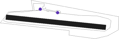
Airport details
| Country | Germany |
| State | North Rhine-Westphalia |
| Region | ED |
| Airspace | Langen Ctr |
| Municipality | Erndtebrück |
| Elevation | 1788ft (545m) |
| Timezone | GMT +1 |
| Coordinates | 51.00000, 8.30694 |
| Magnetic var | |
| Type | land |
| Available since | X-Plane v10.40 |
| ICAO code | EDGQ |
| IATA code | n/a |
| FAA code | n/a |
Communication
| Schameder Schameder Info | 133.585 |
Nearby Points of Interest:
Schloss Bad Berleburg
-St. Katharina
-Alte Mühle
-Altarstein Latrop
-Forsthaus Dietzhölze
-Jüdischer Friedhof (Elsoff)
-Evangelische Kapelle Mandeln
-St. Mariä Heimsuchung
-St. Peter und Paul
-Schenkbarsches Haus
-Pfarrhaus Wormbach
-Evangelische Kirche
-Evangelische Kirche Dodenau
-Protestant Church Altenhundem
-Amtsgericht Schmallenberg
-Laurentiuskirche (Ferndorf)
-Heilig-Kreuz-Kapelle (Bad Fredeburg)
-St. Hubertus und St. Antonius Abt
-Evangelische Kirche Dillbrecht
-Jüdischer Friedhof
-Krupp-Hochhaus Geisweid
-Evangelische Kirche (Wissenbach)
-Altes Forsthaus Rehsiepen
-Amtsgericht Battenberg
-Evangelische Kirche Haiger-Niederrossbach
Nearby beacons
| code | identifier | dist | bearing | frequency |
|---|---|---|---|---|
| GMH | GERMINGHAUSEN VOR/DME | 18.7 | 292° | 115.40 |
| SLD | DME | 19.6 | 218° | 108.05 |
| SIL | SIEGERLAND NDB | 20.2 | 208° | 489 |
| COL | COLA VOR/DME | 29.9 | 253° | 108.80 |
| PAD | DME-ILS | 38.4 | 27° | 108.50 |
| PAD | PADERBORN-LIPPSTADT NDB | 39.4 | 28° | 354 |
| DWI | DORTMUND-WICKEDE NDB | 40.4 | 308° | 357 |
| DOR | WICKEDE (DORTMUND) VOR/DME | 40.5 | 308° | 108.65 |
| WRB | WARBURG VOR/DME | 42.8 | 58° | 113.70 |
| TAU | TAUNUS VOR/DME | 45.3 | 191° | 113.35 |
| MTR | METRO VOR | 48.1 | 143° | 110 |
| GED | GEDERN VORTAC | 50.3 | 122° | 110.80 |
| HMM | HAMM VOR/DME | 56.1 | 325° | 115.65 |
| WIB | WIESBADEN TACAN | 57.2 | 180° | 114.10 |
| FR | FRANKFURT NDB | 57.9 | 158° | 297 |
| FFM | FRANKFURT VORTAC | 58.2 | 161° | 114.20 |
| FRD | DME | 59.1 | 165° | 115.90 |
| FW | FRANKFURT NDB | 59.9 | 173° | 382 |
Disclaimer
The information on this website is not for real aviation. Use this data with the X-Plane flight simulator only! Data taken with kind consent from X-Plane 12 source code and data files. Content is subject to change without notice.