Siegerland
Airport details
| Country | Germany |
| State | North Rhine-Westphalia |
| Region | ED |
| Airspace | Langen Ctr |
| Municipality | Burbach |
| Elevation | 1963ft (598m) |
| Timezone | GMT +1 |
| Coordinates | 50.70766, 8.08297 |
| Magnetic var | |
| Type | land |
| Available since | X-Plane v10.40 |
| ICAO code | EDGS |
| IATA code | SGE |
| FAA code | n/a |
Communication
| Siegerland ATIS | 128.625 |
| Siegerland Siegerlan-INFO | 120.380 |
| Siegerland LANGEN RADAR | 124.900 |
Approach frequencies
| ILS-cat-I | RW31 | 108.9 | 18.00mi |
| 3° GS | RW31 | 108.9 | 18.00mi |
Nearby Points of Interest:
Evangelische Kirche
-Ehemalige Evangelische Kirche
-Protestant Church
-Evangelische Kirche Haiger-Allendorf
-Evangelische Kapelle
-Katholische Kirche
-Oberburg Driedorf
-Evangelische Kirche Driedorf
-Evangelische Kirche Haiger-Rodenbach
-St. Martinus
-St. Aloisius (Herdorf)
-Evangelische Kirche Fellerdilln
-Evangelische Kirche Herborn-Guntersdorf
-Evangelische Kirche Haiger-Niederrossbach
-Evangelische Kirche Dillbrecht
-Kirchenruine Feldbach
-Burgstall Burg
-Amtsgericht Herborn
-Pfarrkirche Nenderoth
-Denkmal 1914/18
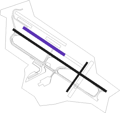
Runway info
Runway 13 / 31  | ||
| length | 1612m (5289ft) | |
| bearing | 116° / 296° | |
| width | 30m (98ft) | |
| surface | asphalt | |
| Runway 04 / 22 | ||
| length | 503m (1650ft) | |
| bearing | 53° / 233° | |
| width | 24m (80ft) | |
| surface | grass | |
| Runway 13L / 31R | ||
| length | 690m (2264ft) | |
| bearing | 117° / 297° | |
| width | 41m (133ft) | |
| surface | grass | |
Nearby beacons
| code | identifier | dist | bearing | frequency |
|---|---|---|---|---|
| SLD | DME | 0.1 | 259° | 108.05 |
| SIL | SIEGERLAND NDB | 2.6 | 116° | 489 |
| COL | COLA VOR/DME | 19.1 | 279° | 108.80 |
| TAU | TAUNUS VOR/DME | 27.6 | 170° | 113.35 |
| GMH | GERMINGHAUSEN VOR/DME | 28.7 | 338° | 115.40 |
| LV | COLOGNE-BONN NDB | 32.5 | 277° | 327 |
| LW | COLOGNE-BONN NDB | 33.5 | 283° | 300 |
| WYP | WIPPER VOR | 36.6 | 293° | 109.60 |
| KBO | COLOGNE-BONN VOR/DME | 36.7 | 279° | 112.15 |
| MTR | METRO VOR | 39 | 119° | 110 |
| WIB | WIESBADEN TACAN | 40.6 | 161° | 114.10 |
| FW | FRANKFURT NDB | 44.2 | 154° | 382 |
| FFM | FRANKFURT VORTAC | 44.6 | 140° | 114.20 |
| FRD | DME | 44.7 | 144° | 115.90 |
| FR | FRANKFURT NDB | 44.8 | 137° | 297 |
| VFM | NAUHEIM VOR | 47.2 | 153° | 113.75 |
| BAM | BARMEN VOR/DME | 50.5 | 304° | 114 |
| DOR | WICKEDE (DORTMUND) VOR/DME | 51.9 | 331° | 108.65 |
| DWI | DORTMUND-WICKEDE NDB | 51.9 | 331° | 357 |
| HAN | HAHN NDB | 54.1 | 227° | 376 |
| FHH | DME | 55.7 | 227° | 117.35 |
| PAD | DME-ILS | 57.8 | 31° | 108.50 |
| RID | RIED VOR/DME | 58.3 | 154° | 112.20 |
| PAD | PADERBORN-LIPPSTADT NDB | 58.8 | 31° | 354 |
| CHA | CHARLIE VOR/DME | 59.8 | 129° | 115.35 |
Departure and arrival routes
| Transition altitude | 5000ft |
| SID end points | distance | outbound heading | |
|---|---|---|---|
| RW13 | |||
| ARPE2S | 20mi | 36° | |
| TOBA2R | 28mi | 101° | |
| NVO1S, NVO1G | 55mi | 275° | |
| RW31 | |||
| ARPE2N | 20mi | 36° | |
| TOBA2K | 28mi | 101° | |
| NVO1H, NVO1L | 55mi | 275° | |
| STAR starting points | distance | inbound heading | |
|---|---|---|---|
| ALL | |||
| ERUK1A | 51.0 | 86° | |
| SIGE5A | 11.1 | 235° | |
| TABU3A | 27.8 | 322° | |
Instrument approach procedures
| runway | airway (heading) | route (dist, bearing) |
|---|---|---|
| RW13 | COL (99°) | COL 6000ft GS130 (9mi, 72°) 5000ft |
| RW13 | SIL (296°) | SIL 6000ft GS131 (17mi, 310°) 6000ft GS130 (4mi, 231°) 5000ft |
| RNAV | GS130 5000ft BETUX (4mi, 116°) 5000ft EDGS (10mi, 116°) 2011ft GS139 (4mi, 116°) (3071mi, 189°) 3000ft SIL (3072mi, 9°) 6000ft | |
| RW31 | SIL (296°) | SIL 6000ft GS313 (15mi, 103°) GS312 (3mi, 128°) GS311 (2mi, 207°) EBOGI (4mi, 271°) 6000ft |
| RW31 | TABUM (322°) | TABUM 6000ft EBOGI (14mi, 11°) 6000ft |
| RNAV | EBOGI 6000ft BEDSI (5mi, 297°) 6000ft EDGS (13mi, 297°) 1978ft GS319 (3mi, 297°) (3075mi, 189°) 3000ft SIL (3072mi, 9°) 6000ft |
Holding patterns
| STAR name | hold at | type | turn | heading* | altitude | leg | speed limit |
|---|---|---|---|---|---|---|---|
| ERUK1A | SIL | FIX | right | 288 (108)° | > 6000ft | 1.0min timed | ICAO rules |
| SIGE5A | SIL | FIX | right | 288 (108)° | > 6000ft | 1.0min timed | ICAO rules |
| TABU3A | SIL | FIX | right | 288 (108)° | > 6000ft | 1.0min timed | ICAO rules |
| *) magnetic outbound (inbound) holding course | |||||||
Disclaimer
The information on this website is not for real aviation. Use this data with the X-Plane flight simulator only! Data taken with kind consent from X-Plane 12 source code and data files. Content is subject to change without notice.