Itzehoe - Itzehoe Hungriger Wolf
Airport details
| Country | Germany |
| State | Schleswig-Holstein |
| Region | ED |
| Airspace | Bremen Ctr |
| Municipality | Hohenlockstedt |
| Elevation | 50ft (15m) |
| Timezone | GMT +1 |
| Coordinates | 53.99319, 9.57526 |
| Magnetic var | |
| Type | land |
| Available since | X-Plane v10.40 |
| ICAO code | EDHF |
| IATA code | n/a |
| FAA code | n/a |
Communication
| Itzehoe Hungriger Wolf Hungriger Wolf Info | 123.375 |
Nearby Points of Interest:
Nagelsche Fachwerkhäuser
-Amtsgericht Itzehoe
-Schloss Heiligenstedten
-St.-Anschar-Kirche
-Wasserturm Remmels
-St.-Nicolai-Kirche
-Wasserturm Aukrug-Böken
-St. Severinkirche
-St. Nikolauskirche
-Brockdorff-Palais
-Rigmor
-Wasmer-Palais
-Königshof (Glückstadt)
-Ehemaliges Frauengefängnis Glückstadt
-Glückstädter Schloss
-Victor-Andersen-Haus
-Pissoir in der Bahnhofstraße
-Neumünster prison
-Altes Rathaus
-Caspar-von-Saldern-Haus
-Villa Wachholtz
-Wasserturm Brunsbüttel
-Grabhügel bei Hemdingen
-Wassermühle Alt-Mühlendorf
-Alte Lotsenstation Nübbel
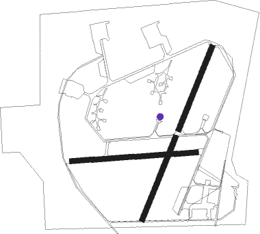
Runway info
Runway 03 / 21  | ||
| length | 501m (1644ft) | |
| bearing | 40° / 220° | |
| width | 30m (98ft) | |
| surface | concrete | |
| blast zone | 40m (131ft) / 14m (46ft) | |
| Runway 02 / 20 | ||
| length | 500m (1640ft) | |
| bearing | 40° / 220° | |
| width | 30m (98ft) | |
| surface | grass | |
| Runway 09 / 27 | ||
| length | 709m (2326ft) | |
| bearing | 90° / 270° | |
| width | 30m (98ft) | |
| surface | grass | |
Nearby beacons
| code | identifier | dist | bearing | frequency |
|---|---|---|---|---|
| HNT | HOHN TACAN | 19.1 | 353° | 115.30 |
| HN | HOHN NDB | 20.2 | 16° | 344 |
| ALF | DME | 26.1 | 131° | 115.80 |
| SWG | SCHLESWIG TACAN | 28.3 | 353° | 111.80 |
| HAM | HAMBURG VORTAC | 28.9 | 116° | 113.10 |
| KIL | KIEL-HOLTENAU NDB | 29.9 | 55° | 353 |
| NDO | NORDHOLZ NDB | 29.9 | 255° | 372 |
| KHD | (HOLTENAU) DME-ILS | 30.6 | 56° | 109.50 |
| NDO | NORDHOLZ TACAN | 35.2 | 256° | 117.10 |
| WSN | WESER NDB | 46.1 | 227° | 378 |
| ALS | ALSIE VOR | 56.6 | 25° | 114.70 |
| HIG | BREMEN NDB | 61.4 | 215° | 318 |
| BND | DME | 63.6 | 220° | 113.65 |
| BMN | BREMEN VOR/DME | 63.8 | 221° | 117.45 |
Disclaimer
The information on this website is not for real aviation. Use this data with the X-Plane flight simulator only! Data taken with kind consent from X-Plane 12 source code and data files. Content is subject to change without notice.