Hamburg - Hamburg Finkenwerder
Airport details
| Country | Germany |
| State | Hamburg |
| Region | ED |
| Airspace | Bremen Ctr |
| Elevation | 20ft (6m) |
| Timezone | GMT +1 |
| Coordinates | 53.53380, 9.83229 |
| Magnetic var | |
| Type | land |
| Available since | X-Plane v10.40 |
| ICAO code | EDHI |
| IATA code | XFW |
| FAA code | n/a |
Communication
| Hamburg Finkenwerder Finkenwerder ATIS | 123.125 |
| Hamburg Finkenwerder BREMEN INFO | 125.100 |
| Hamburg Finkenwerder Finkenwerder Tower | 123.250 |
| Hamburg Finkenwerder BREMEN RADAR | 124.225 |
| Hamburg Finkenwerder BREMEN RADAR | 134.250 |
Approach frequencies
| ILS-cat-II | RW05 | 110.7 | 18.00mi |
| ILS-cat-I | RW23 | 108.5 | 18.00mi |
| 3° GS | RW05 | 110.7 | 18.00mi |
| 3° GS | RW23 | 108.5 | 18.00mi |
Nearby Points of Interest:
Elbschloss-Brauerei
-Haus K. in O.
-Villa de Freitas
-Vogthof
-Hof Behrmann
-Reichspräsident-Ebert-Kaserne
-Hoop op Welvaart
-Lankenaustift
-Zeisehallen
-Black Form – Dedicated to the Missing Jews
-Osterkirche (Hamburg-Ottensen)
-Behnbrunnen
-Köhlbrandtreppe
-Amtsgericht Hamburg-Altona
-Helenenstift
-Nyegaard-Stift
-St.-Josephs-Kirche
-free school for Israelis
-Fleischgroßmarkt Hamburg
-Hamburger Seemannskirchen
-Schaarhörn
-Schanzenturm
-Kontorhaus Stubbenhuk
-Schröderstift, Hamburg
-Ledigenheim Hamburg
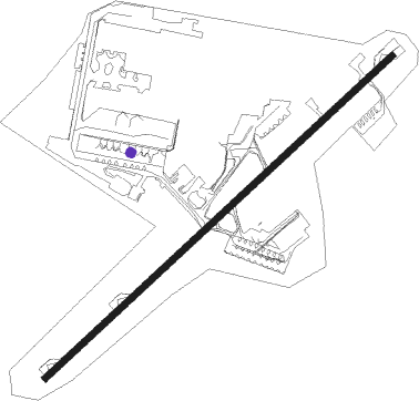
Runway info
| Runway 05 / 23 | ||
| length | 3179m (10430ft) | |
| bearing | 65° / 245° | |
| width | 45m (149ft) | |
| surface | asphalt | |
| displ threshold | 657m (2156ft) / 660m (2165ft) | |
Nearby beacons
| code | identifier | dist | bearing | frequency |
|---|---|---|---|---|
| ALF | DME | 8.3 | 58° | 115.80 |
| HAM | HAMBURG VORTAC | 16.1 | 68° | 113.10 |
| LYE | LUEBECK NDB | 34.6 | 73° | 394 |
| WSN | WESER NDB | 36 | 259° | 378 |
| FSB | FASSBERG NDB | 39.2 | 150° | 284 |
| HIG | BREMEN NDB | 44.1 | 242° | 318 |
| HNT | HOHN TACAN | 47.8 | 339° | 115.30 |
| HN | HOHN NDB | 47.9 | 348° | 344 |
| KIL | KIEL-HOLTENAU NDB | 51.6 | 19° | 353 |
| KHD | (HOLTENAU) DME-ILS | 51.9 | 20° | 109.50 |
| NIE | NIENBURG VOR | 56.9 | 207° | 116.50 |
| SWG | SCHLESWIG TACAN | 56.9 | 341° | 111.80 |
| CEL | CELLE NDB | 57.1 | 168° | 311 |
Departure and arrival routes
| Transition altitude | 5000ft |
| SID end points | distance | outbound heading | |
|---|---|---|---|
| RW05 | |||
| HAM1E, HAM1R | 16mi | 68° | |
| RAMA4E | 41mi | 81° | |
| AMLU9E | 19mi | 102° | |
| IDEK8E | 35mi | 215° | |
| BASU4E | 59mi | 234° | |
| ELSO1E | 11mi | 295° | |
| RW23 | |||
| HAM2W, HAM1V | 16mi | 68° | |
| RAMA5W | 41mi | 81° | |
| AMLU9W | 19mi | 102° | |
| IDEK6W | 35mi | 215° | |
| BASU1W | 59mi | 234° | |
| ELSO1W | 11mi | 295° | |
Instrument approach procedures
| runway | airway (heading) | route (dist, bearing) |
|---|---|---|
| RW05 | BOGMU (226°) | BOGMU HI225 (16mi, 162°) HI226 (4mi, 244°) HI227 (4mi, 244°) HI228 (4mi, 244°) HI229 (4mi, 244°) HI230 (4mi, 244°) HI231 (4mi, 244°) HI232 (4mi, 243°) HI233 (4mi, 243°) HI234 (4mi, 243°) HI235 (4mi, 243°) HI255 (5mi, 305°) 4000ft HI256 (4mi, 65°) 3000ft |
| RW05 | HAM (248°) | HAM 4000ft HI227 (3mi, 181°) HI228 (4mi, 244°) HI229 (4mi, 244°) HI230 (4mi, 244°) HI231 (4mi, 244°) HI232 (4mi, 243°) HI233 (4mi, 243°) HI234 (4mi, 243°) HI235 (4mi, 243°) HI255 (5mi, 305°) 4000ft HI256 (4mi, 65°) 3000ft |
| RW05 | NOLGO (294°) | NOLGO HI230 (9mi, 298°) HI231 (4mi, 244°) HI232 (4mi, 243°) HI233 (4mi, 243°) HI234 (4mi, 243°) HI235 (4mi, 243°) HI255 (5mi, 305°) 4000ft HI256 (4mi, 65°) 3000ft |
| RW05 | RARUP (263°) | RARUP HI230 (27mi, 259°) HI231 (4mi, 244°) HI232 (4mi, 243°) HI233 (4mi, 243°) HI234 (4mi, 243°) HI235 (4mi, 243°) HI255 (5mi, 305°) 4000ft HI256 (4mi, 65°) 3000ft |
| RW05 | RIBSO (120°) | RIBSO HI210 (7mi, 112°) HI211 (4mi, 229°) HI213 (12mi, 158°) HI214 (4mi, 243°) HI215 (4mi, 243°) HI255 (5mi, 125°) 4000ft HI256 (4mi, 65°) 3000ft |
| RNAV | HI256 3000ft ERLEK (4mi, 65°) 3000ft EDHI (10mi, 65°) 65ft HI019 (4mi, 65°) HAM (12mi, 69°) 4000ft | |
| RW23 | BOGMU (226°) | BOGMU HI621 (4mi, 244°) HI633 (4mi, 125°) HI634 (4mi, 64°) HI635 (4mi, 64°) HI655 (5mi, 125°) HI656 (4mi, 244°) HI657 (4mi, 244°) 4000ft HI035 (12mi, 239°) 3000ft |
| RW23 | HAM (248°) | HAM 4000ft HI035 (3mi, 262°) 3000ft |
| RW23 | NOLGO (294°) | NOLGO HI609 (11mi, 353°) HI610 (4mi, 64°) HI611 (4mi, 64°) HI612 (4mi, 64°) HI613 (4mi, 64°) HI614 (4mi, 64°) HI615 (4mi, 64°) HI655 (5mi, 306°) HI656 (4mi, 244°) HI657 (4mi, 244°) 4000ft HI035 (12mi, 239°) 3000ft |
| RW23 | RARUP (263°) | RARUP HI600 (10mi, 253°) HI611 (8mi, 306°) HI612 (4mi, 64°) HI613 (4mi, 64°) HI614 (4mi, 64°) HI615 (4mi, 64°) HI655 (5mi, 306°) HI656 (4mi, 244°) HI657 (4mi, 244°) 4000ft HI035 (12mi, 239°) 3000ft |
| RW23 | RIBSO (120°) | RIBSO HI620 (17mi, 83°) HI632 (14mi, 94°) HI633 (4mi, 64°) HI634 (4mi, 64°) HI635 (4mi, 64°) HI655 (5mi, 125°) HI656 (4mi, 244°) HI657 (4mi, 244°) 4000ft HI035 (12mi, 239°) 3000ft |
| RNAV | HI035 3000ft TAMAB (4mi, 245°) 3000ft EDHI (10mi, 245°) 65ft HI038 (3mi, 245°) HAM (19mi, 67°) 4000ft |
Disclaimer
The information on this website is not for real aviation. Use this data with the X-Plane flight simulator only! Data taken with kind consent from X-Plane 12 source code and data files. Content is subject to change without notice.