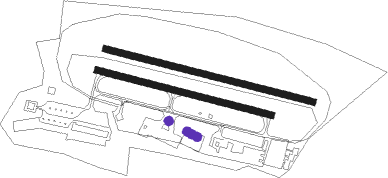
Bonn - Bonn-hangelar
Airport details
| Country | Germany |
| State | North Rhine-Westphalia |
| Region | ED |
| Airspace | Langen Ctr |
| Municipality | Sankt Augustin |
| Elevation | 193ft (59m) |
| Timezone | GMT +1 |
| Coordinates | 50.76893, 7.15307 |
| Magnetic var | |
| Type | land |
| Available since | X-Plane v10.32 |
| ICAO code | EDKB |
| IATA code | BNJ |
| FAA code | n/a |
Communication
| Bonn-Hangelar Bonn-Hangelar Info | 135.155 |
Nearby Points of Interest:
Missionshaus St. Augustin
-Alte Kirche St. Augustinus
-St. Josef (Beuel)
-Mehlem'sches Haus
-Villa Hoeller
-Beethovenhalle
-Graurheindorfer Straße 90
-Auermühle
-Ringstraße 21
-Sankt-Agnes-Stift (Bonn)
-Marienkapelle
-St. Johannes-Hospital
-Graurheindorfer Straße 157
-Konviktstraße 11 (Bonn)
-Bonngasse 18
-Adenauerallee 7
-Metropol
-University and State Library Bonn
-Markt 33
-Markt 35
-LVR-Klinik Bonn
-Treppenaufgang Rathenauufer/Schaumburg-Lippe-Straße
-Electoral Palace
-Adenauerallee 81–83
-Adenauerallee 89a

Nearby beacons
| code | identifier | dist | bearing | frequency |
|---|---|---|---|---|
| LV | COLOGNE-BONN NDB | 3.9 | 68° | 327 |
| KBO | COLOGNE-BONN VOR/DME | 5.5 | 355° | 112.15 |
| LW | COLOGNE-BONN NDB | 8.6 | 38° | 300 |
| LJ | COLOGNE-BONN NDB | 10.1 | 330° | 365 |
| COL | COLA VOR/DME | 16.7 | 88° | 108.80 |
| WYP | WIPPER VOR | 17.4 | 24° | 109.60 |
| WNN | DME | 18.7 | 278° | 109.85 |
| NVO | NOERVENICH VORTAC | 19.8 | 276° | 116.20 |
| BAM | BARMEN VOR/DME | 33.5 | 2° | 114 |
| DY | DUESSELDORF NDB | 33.7 | 313° | 284 |
| DUS | DUESSELDORF VOR/DME | 34.3 | 322° | 115.15 |
| SLD | DME | 35.3 | 94° | 108.05 |
| BUE | BUECHEL TACAN | 35.5 | 188° | 117.10 |
| LI | DUESSELDORF NDB | 36 | 336° | 417 |
| GMH | GERMINGHAUSEN VOR/DME | 36.9 | 61° | 115.40 |
| MHD | DME | 37.5 | 305° | 112.50 |
| MHV | MOENCHENGLADBACH VOR | 37.6 | 305° | 109.80 |
| SIL | SIEGERLAND NDB | 37.8 | 95° | 489 |
| LMA | LIMA NDB | 46.1 | 308° | 311 |
| HAN | HAHN NDB | 48.5 | 171° | 376 |
| DOR | WICKEDE (DORTMUND) VOR/DME | 48.8 | 32° | 108.65 |
| DWI | DORTMUND-WICKEDE NDB | 48.9 | 32° | 357 |
| BOT | BOTTROP NDB | 49.3 | 351° | 406 |
| FHH | DME | 49.8 | 173° | 117.35 |
| SPA | SPANGDAHLEM TACAN | 50.5 | 210° | 109.50 |
| LAA | NIEDERRHEIN NDB | 62.1 | 310° | 352 |
Disclaimer
The information on this website is not for real aviation. Use this data with the X-Plane flight simulator only! Data taken with kind consent from X-Plane 12 source code and data files. Content is subject to change without notice.