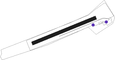
Kamp-lintfort
Airport details
| Country | Germany |
| State | North Rhine-Westphalia |
| Region | ED |
| Airspace | Langen Ctr |
| Municipality | Kamp-Lintfort |
| Elevation | 80ft (24m) |
| Timezone | GMT +1 |
| Coordinates | 51.52889, 6.53611 |
| Magnetic var | |
| Type | land |
| Available since | X-Plane v10.32 |
| ICAO code | EDLC |
| IATA code | n/a |
| FAA code | n/a |
Communication
| Kamp-Lintfort Kamp-Lintfort Info | 125.315 |
Nearby beacons
| code | identifier | dist | bearing | frequency |
|---|---|---|---|---|
| LMA | LIMA NDB | 10.8 | 222° | 311 |
| LAA | NIEDERRHEIN NDB | 14.2 | 281° | 352 |
| NID | DME | 15.3 | 280° | 115.50 |
| DUS | DUESSELDORF VOR/DME | 16.8 | 138° | 115.15 |
| LI | DUESSELDORF NDB | 17.2 | 117° | 417 |
| MHV | MOENCHENGLADBACH VOR | 17.5 | 189° | 109.80 |
| MHD | DME | 17.7 | 189° | 112.50 |
| DY | DUESSELDORF NDB | 18.2 | 158° | 284 |
| BOT | BOTTROP NDB | 18.4 | 83° | 406 |
| BAM | BARMEN VOR/DME | 26.8 | 107° | 114 |
| VKL | VOLKEL TACAN | 31.8 | 279° | 108.30 |
| RKN | DME | 37.2 | 21° | 116.80 |
| GIX | GEILENKIRCHEN TACAN | 38.6 | 221° | 108.10 |
| NW | MAASTRICHT NDB | 39.3 | 232° | 373 |
| MAS | MAASTRICHT VOR/DME | 39.8 | 226° | 108.60 |
| DLN | DEELEN TACAN | 40.1 | 309° | 112.20 |
| WYP | WIPPER VOR | 40.1 | 123° | 109.60 |
| LJ | COLOGNE-BONN NDB | 41.2 | 139° | 365 |
| WNN | DME | 41.9 | 169° | 109.85 |
| NVO | NOERVENICH VORTAC | 42.5 | 172° | 116.20 |
| KBO | COLOGNE-BONN VOR/DME | 46.1 | 138° | 112.15 |
| LW | COLOGNE-BONN NDB | 46.4 | 131° | 300 |
| LV | COLOGNE-BONN NDB | 50.9 | 136° | 327 |
| ONL | LIEGE NDB | 62 | 230° | 290 |
| LNO | OLNO VOR/DME | 64.6 | 221° | 112.80 |
Disclaimer
The information on this website is not for real aviation. Use this data with the X-Plane flight simulator only! Data taken with kind consent from X-Plane 12 source code and data files. Content is subject to change without notice.
