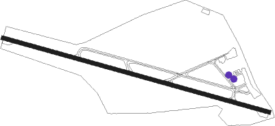
Bielefeld - Bielefeld- Windelsbleiche
Airport details
| Country | Germany |
| State | North Rhine-Westphalia |
| Region | ED |
| Airspace | Langen Ctr |
| Municipality | Bielefeld |
| Elevation | 433ft (132m) |
| Timezone | GMT +1 |
| Coordinates | 51.96483, 8.54483 |
| Magnetic var | |
| Type | land |
| Available since | X-Plane v10.40 |
| ICAO code | EDLI |
| IATA code | BFE |
| FAA code | n/a |
Communication
| Bielefeld- Windelsbleiche Bielefeld Info | 118.350 |
Nearby Points of Interest:
Römische Kreisgrabenanlage auf der Sparrenberger Egge
-Beckhof
-Handwerker- und Kunstgewerbeschule Bielefeld
-Landgericht Bielefeld
-Spiegelshof
-Crüwell-Haus (Bielefeld)
-Battig-Haus
-Haus der Technik
-Ostmannturm
-Gut Menkhausen
-St. Joseph (Bielefeld)
-Pfarrhaus Oerlinghausen
-Robert-Koch-Straße 17 (Oerlinghausen)
-Hauptstraße 32
-Hauptstraße 19
-Rathaus Oerlinghausen
-Melmsche Hirsch-Apotheke (Oerlinghausen)
-Detmolder Straße 20 (Oerlinghausen)
-Detmolder Straße 24 (Oerlinghausen)
-Hof Meyer zu Bentrup
-Dorfmühle
-Wellensiek
-Holtkämperei
-Brennerei Elmendorf
-Hof Johannliemke
Nearby beacons
| code | identifier | dist | bearing | frequency |
|---|---|---|---|---|
| OSB | OSNABRUCK TACAN | 17 | 312° | 108.35 |
| OSN | OSNABRUECK VOR | 17 | 312° | 114.30 |
| PAD | PADERBORN-LIPPSTADT NDB | 20.7 | 165° | 354 |
| PAD | DME-ILS | 21.4 | 168° | 108.50 |
| BYC | BUECKEBURG NDB | 28 | 59° | 368 |
| MYN | MUENSTER/OSNABRUECK NDB | 29.8 | 285° | 371 |
| HMM | HAMM VOR/DME | 31.6 | 263° | 115.65 |
| MOD | DME | 33.3 | 281° | 114.05 |
| WRB | WARBURG VOR/DME | 34.6 | 129° | 113.70 |
| DP | DIEPHOLZ NDB | 37.7 | 352° | 325 |
| DWI | DORTMUND-WICKEDE NDB | 42.8 | 244° | 357 |
| DOR | WICKEDE (DORTMUND) VOR/DME | 43 | 244° | 108.65 |
| WUN | WUNSTORF TACAN | 43.8 | 61° | 114.85 |
| DKS | DME-ILS | 45.7 | 122° | 111.50 |
| NIE | NIENBURG VOR | 49.9 | 51° | 116.50 |
| GMH | GERMINGHAUSEN VOR/DME | 53.5 | 219° | 115.40 |
| FTZ | FRITZLAR NDB | 62 | 135° | 468 |
Disclaimer
The information on this website is not for real aviation. Use this data with the X-Plane flight simulator only! Data taken with kind consent from X-Plane 12 source code and data files. Content is subject to change without notice.